Can a DJI Mini Make a Survey Map in India? What the Output Can Prove
A DJI Mini can create useful visual maps, but positional accuracy and boundary claims need measured control, independent checks and a clear...
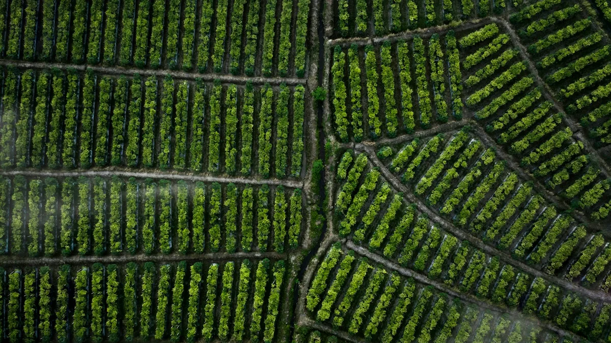
A DJI Mini can collect overlapping aerial photographs, and photogrammetry software can turn suitable photographs into a mosaic or model. That is enough to make a useful site overview, construction progress image or visual inventory. It is not enough, on its own, to promise a survey map with a specified positional accuracy. The difference matters in India when a property owner wants a boundary, an engineer needs a design base or a buyer is judging a parcel from a marketing image. A sharp picture is not proof that every point in it occupies the correct map coordinate.
DJI's Mini 4 Pro specifications describe a camera with timed still capture and ordinary onboard positioning. The OpenDroneMap documentation explains ground control, and the ASPRS positional accuracy standards explain independent accuracy assessment. India’s SVAMITVA guidance shows that an official mapping programme uses a broader survey and validation workflow. Those sources support a practical distinction: a Mini can be a camera for a mapping project, but the project result must be judged by its method and tests. The aircraft name is not an accuracy class.
Start with the question the map will answer
For a weekly construction update, the client may need to see whether earthwork has moved and where materials were staged. A visual orthomosaic with a stated date may be fit for that purpose even if its absolute coordinates are approximate. For a drainage design, the client may need heights, a reliable datum and surface accuracy. For a property boundary, images alone cannot replace legal records and a qualified surveyor's method. Write the intended use before choosing camera height or software. Otherwise the same image can be oversold after it is delivered.
Define the required file type, area, resolution, horizontal and vertical accuracy if any, reference system and review method. Ask whether change detection is relative to the previous flight or to an official coordinate base. A consumer may say “make a map” when they mean a labelled aerial poster. Another may expect a CAD-ready engineering surface. Those two outputs require very different field work, processing and sign-off. A producer should quote them separately.
What the Mini can capture well
A Mini's small size makes it easy to carry to a permitted launch area, and its camera can capture a compact site with substantial image overlap. DJI lists timed still-photo modes for models such as the Mini 4 Pro, but a timed sequence alone does not guarantee a correctly spaced mapping grid. Check which route-planning or capture functions are actually supported by the exact model, controller and software version. Do not assume that an accessory app can legally or safely fly a route just because it advertises waypoint support.
For a visual mosaic, plan consistent altitude, camera angle, exposure and overlap, then inspect sample images on site. Good overlap helps matching; too little creates holes, while many nearly identical blurry images only increase processing time. OpenDroneMap's documentation provides general overlap and control concepts, but each site has its own texture and relief. Trees moving in wind, bright metal roofs, water and repetitive facades are harder to reconstruct than a stable textured field. The best flight path follows the actual subject rather than a preset chosen without looking at the ground.
Where positional error enters
The Mini's GNSS positioning helps flight and tags images, but the position of a photo centre is not a surveyed coordinate for every feature in the final mosaic. Camera calibration, lens geometry, shutter timing, tilt, relief and software matching all affect the block. The Mini 4 Pro specification describes an electronic photo shutter, unlike the mechanical wide-camera shutter DJI highlights on its Mavic 3 Enterprise. Motion can therefore matter more in some mapping captures. Keep the aircraft slow enough for sharp stills and inspect the real images, not only the route preview.
Without measured ground points, software may produce a visually seamless mosaic with an overall offset, rotation or local stretch. Overlaying it on a web basemap does not prove its absolute accuracy because the basemap can have its own error. Using a phone's coordinate reading for a “control point” generally does not turn the map into a precise survey. If the client needs a measurable position, commission suitable ground control from a survey professional and record the coordinate datum and measurement method.
Control points are not the same as checkpoints
Ground control points help align the photogrammetric block. Put targets where they can be seen clearly in multiple images and spread them across the site rather than clustering them near the launch area. Independent checkpoints are withheld from the adjustment and compared with the delivered map. They provide evidence of how well the final product performs away from the points used to force the fit. Reporting only the residuals of control points used in processing can make accuracy look better than an independent test would show.
The number and placement of checks should be chosen for the project size and the claimed accuracy, following the relevant standard and contract. Do not invent a single universal number for all Mini projects. Report horizontal and vertical performance separately. A flat visual mosaic might meet a client’s communication need while a derived elevation model does not meet a grading design tolerance. Label low-confidence areas such as beneath trees or beside reflective water. If the field crew could not reach part of the ground, disclose that limitation instead of filling it with a confident-looking surface.
Policy, access and ownership of the data
The Mini remains an aircraft when its purpose is mapping. Check DigitalSky for the current zone, route and planned height. Resolve the registration or UIN and pilot-credential questions for the actual aircraft and use under the current Drone Rules. Obtain land access and permission to place ground targets. Avoid capturing neighbours, private interiors or sensitive facilities unnecessarily. A client who owns a parcel may not control the road or adjacent compound needed for the best flight geometry.
Agree in writing who receives raw photos, control coordinates, processing project files, an orthomosaic and any derived model. State whether the output is for visual planning, internal measurement, engineering design or legal boundary work. These labels affect how a future recipient may rely on the file. A convenient aerial image can be copied into a proposal years later after the site has changed; a date and use statement prevent that quiet escalation. Back up originals and processing logs so the map can be rechecked if a client questions a feature.
A useful Mini deliverable with honest limits
For a small facility, a credible package can include a dated orthomosaic, a few oblique context photos, a coordinate reference note, the ground-control method if used, checkpoint results if accuracy is claimed, and a plain-language limitation statement. If no ground control was measured, say that the mosaic is a visual record and do not quote survey-grade accuracy. If a volume is requested, define the base surface and test the result; an attractive 3D mesh alone is not a validated quantity. Where the question affects ownership or design, involve the appropriate professional.
The DJI Mini is useful because it can collect accessible overhead views with a small kit. Its limitation is not that a map is impossible; it is that an image collection is only one part of a dependable survey. Ask the client what decision the map must support, build the ground and validation plan to match, and choose a larger survey platform when the Mini cannot supply the required repeatability. That is how a small drone can contribute real value without making claims the finished map cannot prove.
Contact SkyViews Aerial Drone Studio at +91 90190 56479 or skyviewsdronestudio@gmail.com. Service area: Bangalore, Karnataka and India and wider Bangalore, Karnataka and India.