DJI Mini for Property Marketing in India
How to use a compact DJI Mini for honest property footage, including the brief, launch permission, privacy, framing and deliverable review.
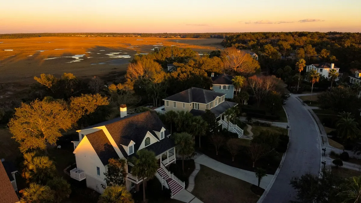
A compact DJI Mini can add useful context to an Indian property listing: the building's position on a road, an open-space relationship, roof condition or the scale of a campus. It can also create misleading marketing if the camera hides a neighbouring structure, exaggerates a view or suggests a private terrace is part of the property. Good aerial property work begins with an agreed story and accurate labels. The aircraft is a means of capturing that story, not a reason to add a dramatic flight where a ground photograph would explain the site better.
DJI's Mini 4 Pro specifications describe a compact wide camera and true vertical shooting; other Mini models have different camera limits, so the exact product matters. India's Drone Rules, 2021 and the DigitalSky map govern aircraft and airspace questions. The seller, client or camera app cannot grant launch-site access or decide a neighbour's privacy rights. Treat each property as a new production site with its own permissions and sensitivities.
Write the listing claim before writing the shot list
Ask the client what the aerial image must establish. Is it access from a main road, distance between buildings, a visible landscaped courtyard, a view from a particular floor, or the extent of a roof? Each claim suggests a different camera height and angle. A high, wide view can show site context but may make the target building small. A low approach can make the architecture legible but conceal the wider surroundings. Use both when the brief needs both. Do not substitute a cinematic sweep for a required factual view.
Record which features are verified, under construction, planned or outside the property boundary. An aerial view of an adjacent park is not proof that the park belongs to the development. A camera angle that combines a distant landmark with the building may visually compress the distance; label it as a contextual view if the proximity could be misunderstood. If a brochure requires exact distances, obtain them from an appropriate source rather than estimating from a drone frame. A credible property film shows the asset attractively without asking viewers to infer something unsupported.
Scout from the ground first
Walk the permitted launch area and the likely camera line. Note wires, cranes, trees, antennas, reflective glass, birds, rooftop edges, vehicles and people. Identify the actual property limits and nearby private windows. A drone that is easy to carry may tempt a pilot to launch from a narrow pavement; that can be the worst place for bystander control or recovery. Secure a ground area large enough for takeoff and landing, plus an alternate landing option. Agree with the property manager on when access begins and who can pause the flight.
Check the current DigitalSky zone for the entire intended route and height. Green airspace generally avoids prior airspace permission under the Rules, subject to the map limits and other requirements; yellow and red have separate approvals. The aircraft's small weight does not open an airport approach or an event restriction. Confirm the exact battery and accessories for the Mini's all-up weight and the current registration or pilot-credential position. A standard Mini and the same model with a heavier optional pack can raise different compliance questions.
Build a small set of useful frames
One establishing image should identify the property immediately, not after an editor adds a circle. A second frame can show the entrance or approach route from an angle that does not misrepresent road access. A third can show a genuine feature such as a courtyard, roof or view. Add a slow motion clip for scale and one native vertical version if the aircraft supports it and social delivery is part of the contract. Keep the moves short and legible. A single smooth reveal often works better than a complex orbit that exposes neighbouring balconies and adds little to the listing.
Test the light on the actual facade. Midday sun may flatten a building or blow out white finishes. Early or late light can give texture but may place the main face in deep shadow. For a small sensor, protect important highlights and avoid promising extensive rescue in editing. Haze in many Indian cities can make a distant skyline less useful than a closer contextual frame. If wind or rain approaches, postpone the aerial portion or switch to ground images. A client's fixed opening date is not a weather exemption.
Keep private activity out of the story
An apartment drone shot can capture people on balconies, children in a courtyard, vehicle number plates or interiors through glass. Plan angles to minimise unnecessary capture. Inform the property manager and occupants where appropriate, and avoid flying close to windows. If a frame includes incidental private activity, evaluate whether it should be excluded or blurred before publication. A studio should agree with the client who reviews the material and who authorises use. Never use a neighbour's courtyard merely because it makes a striking foreground.
The observer should watch both the aircraft and the ground around it. Give them authority to call for an abort if non-participants enter the area. If a rooftop is busy with maintenance staff, reschedule the move or narrow the route. Obstacle sensors do not detect consent, and a propeller guard does not make a flight over people a routine shot. A good site brief names the pilot, observer, property contact, launch spot, route, weather stop and emergency landing place. That brief is as relevant to a ten-second reel as to a long film.
Edit for accurate viewing
Choose the frames that answer the listing question and label them clearly. Keep a natural horizon and plausible perspective. Avoid aggressive speed ramps, excessive saturation and dramatic crops that obscure a road, nearby building or construction status. A vertical social cut and horizontal website cut may require separate captures; a crop from one wide master can remove the very context the viewer needs. Review both formats on the intended screen size. Add simple location labels only when the position and spelling have been checked with the client.
Keep the original files, the approved shot list and a dated export. If the site changes during construction, an older aerial view should not quietly be presented as current. Record the date of capture and the stage of work; for a time-lapse, keep camera positions and framing consistent enough for a fair comparison. Do not turn a marketing view into a boundary survey or measurement claim. If the client later needs cadastral, elevation or engineering information, commission a separate mapping workflow with ground control and validation.
Select the Mini only when it fits the brief
A DJI Mini can be an efficient tool for a small property with a nearby lawful launch area and a short, clear route. Its portable kit and, on selected models, native vertical capture suit social content. A larger sensor or second focal length may be needed when the site is distant, the light is difficult or the subject requires a compressed detail view. A ground camera or an approved elevated viewpoint may be better when airspace, neighbours or obstacles make a drone route unsuitable. Choose the capture method after the site survey, not before.
For an Indian property client, the useful deliverable is a set of truthful frames that make the asset easier to understand. The crew should show where it may fly, what it will show, how it will avoid private activity and what the final file will claim. If those questions are answered before launch, a short Mini flight can add clarity without creating avoidable risk or an inflated story.
Contact SkyViews Aerial Drone Studio at +91 90190 56479 or skyviewsdronestudio@gmail.com. Service area: Bangalore, Karnataka and India and wider Bangalore, Karnataka and India.