Drone Inspection for Substations and Electrical Assets in India
A planning guide for aerial visual documentation around substations, transmission assets and electrical infrastructure.
By SkyViews Aerial Drone Studio
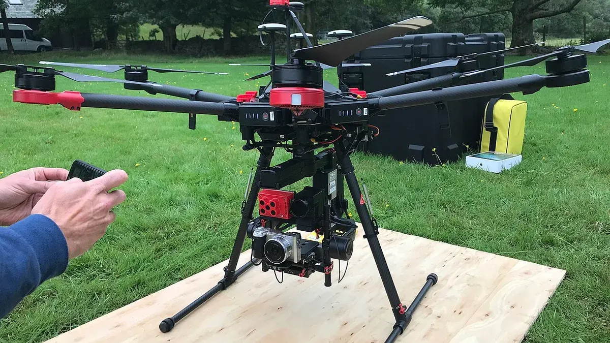
A substation or transmission site has equipment that can be difficult to view from ordinary ground positions. Roofs, gantries, towers, bus structures, drainage and vegetation may all matter to the asset team. A drone can make a dated visual record of selected areas without sending a person to every high or awkward viewpoint. The request must still begin with the site's safety rules and the owner's technical question. A camera does not make live electrical equipment safe to approach.
This guide is for Indian utilities, facility owners and inspection coordinators planning aerial visual documentation. It explains how to brief the work, choose evidence, protect the site and hand findings to qualified reviewers. It does not set operating clearances or electrical procedures. Those are determined for the actual asset by the owner, applicable requirements and the pilot's safety assessment.
Name the asset and the decision
List the substation, bay, tower, building or corridor segment by the owner's asset ID. Say whether the task is a baseline overview, visible condition record, vegetation review, post-weather documentation, construction progress or thermal screening. These are separate questions. A wide overview can explain the yard layout, while a thermal assessment of a named connector needs a different sensor, angle and operating context.
Identify who will use the images. An electrical engineer may need detailed frames linked to a bay and component. A project manager may need a dated overview of construction. A maintenance planner may need access and drainage context. A public communications team may want a limited image of the facility. One unrestricted video is unlikely to serve all four without confusion or unnecessary security exposure.
Agree the required image quality and the minimum useful detail. If the necessary view would require an unsafe position or distance, mark that task for another method. The owner should never assume that a drone can reach every component simply because it can fly.
Plan with the electrical site team
The facility contact should brief the crew on live equipment, conductors, restricted zones, approved access, switching activity, overhead hazards, vehicles, workers and emergency arrangements. Equipment may look similar from above while having very different operating states. The operator should not infer safe areas from visual appearance.
The owner and qualified operator must agree on a flight boundary and any approach restrictions for the specific site. Relevant airspace, weather, aircraft behaviour and the consequences of a loss of control must be reviewed. Electromagnetic conditions and structures may affect the planned operation. If the operator cannot maintain the agreed controls, the flight should be changed or cancelled. Do not turn this guide into a fixed distance rule; the correct plan depends on the actual installation and applicable requirements.
Mark a launch and recovery area outside normal electrical work routes. Decide who can stop the flight and how that message reaches the pilot. If maintenance activity or an alarm changes the site state, the crew needs an immediate way to respond. A pre-flight walk and short joint briefing can prevent the crew from filming a bay that the owner intended to exclude.
Build a traceable shot list
Start with an overview that shows the location of named bays and buildings. Then capture approved views of the target components. Give each view an ID that combines site, bay, asset, direction and date. A close image of a mark is hard to use when no wider frame shows where it came from.
Ask the owner for a simple plan or asset list. If the field labels differ from the drawing, agree a cross-reference. Photographing the right object under the wrong name can create a serious reporting problem. The reviewer should be able to find the original image, the asset and the exact observation without guessing.
The visible-light set may show vegetation near a fence, water around a road, a roof surface, a tower member or an equipment enclosure. Record glare, shadow, distance and obstruction. If a view is partly blocked by cables or structures, label the covered area as incomplete. Do not fill the gap with an assumption of good condition.
Treat thermal work as a separate technical scope
A thermal camera displays differences in apparent temperature. It may help a qualified reviewer identify a pattern that deserves follow-up. That pattern is influenced by operating load, weather, sun, angle, surface properties and camera settings. A bright colour on a display is not a diagnosis by itself. Record the conditions and sensor information required by the chosen inspection method.
Pair thermal and visible images so the reviewer can locate the component. Keep the original thermal data where the scope calls for it; a colourful screenshot may lose the measurement context. The owner's electrical specialist should compare the pattern with operating records and decide whether testing, a ground inspection or other action is needed.
Do not claim that a thermal flight proves all connections are sound. Some components may be hidden, de-energised or outside useful viewing conditions. A report should have a coverage section that shows what was actually assessed. The thermal building-envelope guide describes similar caution about interpreting image patterns in another setting.
Write observations that can be checked
Each report item needs the asset ID, image reference, capture time, visible observation, limitation and next owner. “Vegetation visible against the north fence near Bay 3” is an image observation. “Electrical clearance breach” requires the responsible team to measure and judge the situation under its rules. “Dark mark on insulator housing” is different from a confirmed fault.
The owner should define priority criteria and escalation routes before the flight. If a concerning condition is seen, the crew should use the agreed contact rather than waiting to finish a polished deck. The technical team then decides what the observation means and records its follow-up. This keeps the drone report useful without giving the camera operator authority they do not have.
For construction work, distinguish installed-looking equipment from tested or commissioned equipment. An aerial photo can show an erected gantry or completed-looking access road. It cannot confirm electrical tests, earthing, settings or readiness for service. Link the image to the project's formal documents when reporting milestones.
Repeat capture with the same references
If the site wants quarterly or post-weather records, keep a small set of stable viewpoints and asset IDs. Record the date, operating state, sun and weather. An apparent change in colour or heat may come from different conditions rather than a changed asset. Show paired images at comparable scale and identify any difference in method.
Keep a change log of new equipment, repairs, vegetation work and inaccessible areas when the owner supplies that information. A later inspector should know whether an item disappeared because it was repaired, hidden or simply not filmed. Mark missed views and reasons clearly. An empty row in a report is not evidence that the asset is clear.
Preserve original files and prior report versions. Annotated images are easier to discuss, but the clean source lets a reviewer reassess the mark. A repeated programme gains value from traceable history, not just from frequent flights.
Control sensitive images and handover
Substation media may show security arrangements, access points and asset layout. Agree who receives raw files, the inspection report and any public image. Public versions should be reviewed by the owner for security, privacy and accuracy. Give a contractor the approved asset images it needs rather than the full site archive by default.
A useful handover includes the site plan, covered asset list, capture date and conditions, numbered images, observation table, excluded areas and a limitations note. Use filenames that include site, bay, asset and version. The electrical asset owner should sign off the interpretation and follow-up, while the image package remains a record of what the camera saw. For other external-asset methods, see the industrial roof and facade inspection guide.
FAQs
Can a drone fly close to live electrical equipment?
Only if the owner and qualified operator can approve a site-specific plan that meets all applicable safety and operating requirements. Some requested views will need another method.
Can thermal imagery prove an electrical fault?
It can reveal an apparent pattern under suitable conditions. Diagnosis requires qualified review of the image, operating state and other technical evidence.
What makes repeat inspections useful?
Consistent asset IDs, viewpoints, dates, operating notes, source files and documented gaps make a comparison meaningful.
Plan your project
Share your site, dates and intended output so we can confirm a suitable scope.
Telecom, Power & Utilities · Compare project scope · Get in touch
Related reading
- Drone Inspection for Sewer and Utility Corridors in India: Planning Guide
- Powerline, Pipeline & Utility Drone Inspection in Bangalore
- Telecom Tower Drone Inspection Planning in India: Scope and Safety Guide
- Using Drone Data for BIM Coordination and Construction Progress in India
- Drone Damage Mapping for Emergency Response in India: A Field Planning Guide
- Drone Aerial Documentation for Public-Housing Redevelopment Projects
Contact SkyViews Aerial Drone Studio at +91 90190 56479 or skyviewsdronestudio@gmail.com. Service area: Bangalore, Karnataka and India and wider Bangalore, Karnataka and India.