Architecture Aerial Photography in Bangalore
How architecture practices, developers and design teams can use aerial photography and video to document buildings, context, landscape and...
By SkyViews Aerial Drone Studio
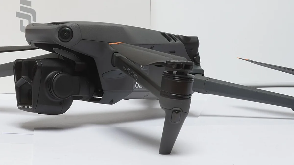
An aerial photograph can show how a building sits within its site. It may reveal the entrance, a courtyard, nearby trees or the shape of a roof in one frame. Ground photographs still matter for materials, rooms and the view a person has at street level. Together, the images can tell a clearer story than either set alone.
This guide helps architects and developers in Bangalore plan aerial stills and short films. It follows the job from the design brief to the final files. It also explains what changes the scope and cost. No camera model or editing trick can make a view truthful if the building, access or site conditions are misrepresented.
Begin with the design story
Ask the architect what the images should help someone understand. Is the main idea the building's form, the entrance sequence, a shared courtyard or the link between the structure and landscape? Write two or three essential views. Add a few optional views for good light or an unexpected angle. This short list gives the flight team a purpose and gives the client a fair way to review the result.
Name the audience as well. A design award entry may need clean views of form and material. A developer launch may need a wider view showing access and approved amenities. A construction record needs dates and repeatable positions. These are different jobs. Do not ask one dramatic image to prove all three.
Share a site plan, recent ground photographs and the current project stage. Mark private spaces, active work, people and nearby buildings that should stay out of frame. If a design feature is planned but not built, say so. A current photograph should not be edited to imply that future landscaping or a promised road already exists.
Choose useful views
A view that sets the place
A wide frame can show where the building stands relative to its immediate surroundings. The client should check any caption about a road, station or landmark. A camera can show visual proximity, but it cannot verify a travel time or legal access. If a route matters to the story, pair the aerial view with a ground image or a simple approved map.
A view of the building's form
A lower, angled view may show the roofline, facade and entrance better than a straight overhead image. The architect can point out the side that carries the design idea. The flight team then checks whether that angle can be captured from a safe, permitted position. Glass, trees and neighbouring towers may change the view. Keep an alternative angle in the brief.
A view that can be repeated
For progress or before-and-after work, record the camera direction and approximate position at the first visit. Use the same view name later. If a crane or new structure blocks it, choose a replacement and label the change. A pair of photographs is most useful when the viewer can tell which date and view each image represents. A beautiful new angle is not a like-for-like comparison by itself.
Pick the camera after the shot list
Clients often ask for the “best drone” for architectural photography. The answer depends on the size of the building, the light, the safe camera position and where the images will appear. A bigger sensor may help with bright sky and shaded walls, but a careful exposure and good light still matter. Ask to see sample files from the proposed camera at the print or screen size you need.
A mechanical shutter can reduce a type of movement distortion in some capture tasks. It does not straighten a tilted building or remove lens distortion. A wide lens can show more context but may stretch the edges of a frame. A longer lens can isolate a facade detail from farther away, when the site permits the flight. The photographer should test the actual view and keep the building's proportions believable. Buying a specification does not buy a composition.
For stills, ask whether the quote includes selected edited images, web exports, print files or original camera files. For a film, agree on length, aspect ratio, music, captions and review rounds. A vertical social edit may need a different framing from a wide website film. Make that need known before the aircraft launches.
Plan light and flight feasibility together
The direction of light can change how a facade reads. One side may be clear in the morning and flat in the afternoon. A second visit at dusk may show interior light, but it also adds crew time and needs a separate flight-feasibility check. Do not promise a twilight flight only because the camera can record in low light. Current airspace, site access, weather and operating rules decide what can be done.
The pilot should check the live DigitalSky map for the actual location and planned height, along with the current Drone Rules and site conditions. A property owner's invitation does not replace an airspace check. A green-looking map area does not remove the need to manage people, privacy and obstacles. Agree on a safe launch point and a weather alternative before setting a fixed publication date.
In a dense Bangalore street, the preferred view may require flying close to traffic or another building. The crew can suggest a different direction, a lower view or a ground camera. It is better to agree on that trade-off in planning than to force a risky angle on the shoot day. Site security and residents may also need notice or access coordination.
What affects cost?
Architectural photography is usually scoped to the site and final files, not a universal flat rate. The number of locations, access time, travel, crew, light windows and editing all affect the work. A daylight visit and a second dusk visit are not the same scope. A short set of portfolio stills differs from a campaign with several formats and approval rounds.
Ask each provider to list the visit window, views, number of final stills, film outputs, file formats, editing, revisions and usage rights. Ask what happens if weather or permissions prevent a view. Clarify whether source files and future reuse are included. A quote should say who arranges site access and who approves images before public use.
Compare bids on the same brief. A low capture-only quote may exclude selection, editing and final exports. A higher quote may include work the client does not need. Neither can be judged fairly until the outputs match. Our quote comparison example shows a simple way to compare complete scopes.
Review the images honestly
On the proof sheet, check the shape of the building, the colour of materials and whether vertical lines look natural. Lens correction can improve a frame, but too much correction can stretch a corner or make a facade look unlike the real building. Keep the untouched original when the agreement requires a record. If an image is retouched for marketing, agree which edits are allowed and who approves them.
Review the background too. A neighbouring site may belong to someone else, and an empty lot may change later. Do not imply ownership or an approved amenity because it appears in the frame. Check captions for distances, routes and project stage. Aerial views can show what was visible on the capture date; they cannot prove title, structural quality or a future balcony view.
Privacy matters in apartments and mixed-use areas. People, vehicle plates, office windows and private balconies may be visible. Discuss framing, consent and public release with the client and site manager. A small approved selection is easier to review than a folder of every raw image. Keep a record of which version was cleared for a portfolio, award or advert.
Prepare files for their real use
An architect may need high-resolution stills for a portfolio and smaller web files for a site. A developer may need landscape and vertical crops. A magazine may request a particular file type or colour profile. Ask for these requirements early. A large original can be reduced for the web; a small web export cannot recover detail for a print spread.
Write down the usage rights in the agreement. Can the architect submit the photos to an award? Can the developer use them in advertising? May the studio show them in a public portfolio? The answer depends on the contract and any client or site restrictions. A photograph being delivered does not settle every reuse question. Store the final approved masters with their capture date and version so an older construction image is not published as a current completed view.
Example: an office building brief
Imagine a new office building with a landscaped entrance and two main facades. The architect wants six portfolio stills and a short site-context clip. The brief asks for one approach view, two facade views, a courtyard view and a frame showing public space. The developer marks parts of the site that may not be filmed. The team checks the light and flight options, then proposes a safe position for each essential view.
After capture, the architect reviews form and material, while the developer checks captions and usage rights. If parked equipment blocks the courtyard, the team labels the limitation or arranges another view under the agreed terms. This is a planning example, not a claim about a completed SkyViews project.
Questions to settle before booking
What should each image explain? Which spaces may be shown? What is the site's current stage? Who can approve access, the flight and public release? What files and rights are needed? Which two views matter most if weather shortens the visit? Clear answers make the shoot more useful than a long list of camera specifications. Share the site pin, drawings, intended views and uses with our aerial imaging team for a project-specific scope.
Plan your project
Share your site, dates and intended output so we can confirm a suitable scope.
Aerial Imaging & Cinematics · Compare project scope · Get in touch
Related reading
- Real Estate Drone Photography in Bangalore: A Practical Buyer Guide
- Architecture Competition Drone Photography in India: Submission Guide
- Drone Photography for Architects: Portfolio, Project and Design Documentation Guide
- Bridge, Road & Infrastructure Drone Inspection in Bangalore
- Orthomosaic vs 3D Model: Which Drone Survey Output Do You Need?
- Drone Social Media Content in Bangalore: Reels, Shorts & Campaign Planning
Contact SkyViews Aerial Drone Studio at +91 90190 56479 or skyviewsdronestudio@gmail.com. Service area: Bangalore, Karnataka and India and wider Bangalore, Karnataka and India.