Solar Operations and Maintenance Drone Reports in India
How solar asset owners can plan recurring visual and thermal drone reports for module blocks, access, vegetation and maintenance triage.
By SkyViews Aerial Drone Studio
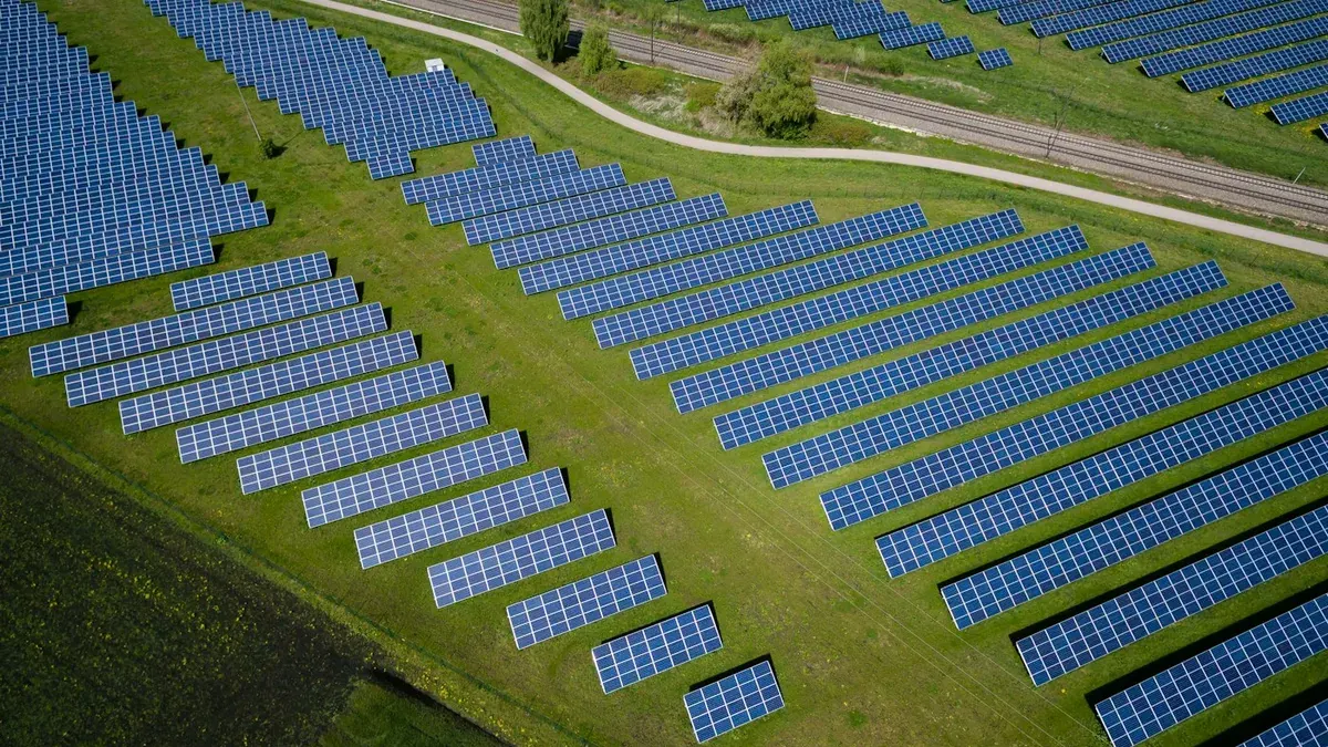
A solar plant can have thousands of modules, service roads, inverters, fences and drainage areas. A drone can help the operations and maintenance team see patterns across that large site and locate places for closer review. It is useful when the images lead to clear actions: a block to check, vegetation to clear or a thermal pattern to investigate. A flight that produces only a long video may look impressive but be hard for technicians to use.
This guide explains how an Indian solar asset owner can plan a repeatable drone report. It covers visual and thermal capture, asset references, operating conditions, careful interpretation and a handover that fits the maintenance workflow. Drone images can flag anomalies. They do not by themselves prove a module fault, measure lost generation or replace electrical testing.
Start with the maintenance question
The owner should state the purpose of the visit. Possible aims include a baseline image set, visual module review, thermal screening, vegetation and access review, post-weather checks or follow-up on a known underperforming block. A rooftop system may need a very different plan from a ground-mounted plant. Some visits may need only visible-light photographs; thermal work requires a suitable sensor, conditions and trained interpretation.
Give the flight team the latest layout with block, row, string and inverter identifiers where available. Ask the O&M lead which naming scheme technicians use in the field. If the report says “hotspot near the south edge” but the technician cannot identify the row, the finding is not actionable. Agree how coordinates, row numbers and images will be linked before capture.
Set the receiving audience. A site technician needs exact location and source images. An asset manager may need a short summary of findings and follow-up status. A public sustainability film needs a different edit and should not be confused with inspection evidence.
Plan around the plant's operating state
Thermal appearance depends on conditions. Sunlight, cloud, wind, module temperature, shadows and electrical loading can change what the camera sees. Record the actual capture time, weather and relevant plant operating information supplied by the owner. If cloud moves over part of the array or the system is not in the expected state, note the affected blocks. Do not compare two thermograms as if their colours have the same meaning without checking the conditions and settings.
The qualified inspection team should set the image resolution, angle and conditions needed for the intended thermal method. IEA PVPS guidance on mobile PV inspection explains why flight planning and stable illumination matter. The project specification should refer to the current applicable method chosen by the owner rather than treating any thermal camera flight as a complete inspection.
Also review the physical site. There may be overhead power lines, tracking structures, workers, cleaning crews, vehicles, uneven ground and restricted electrical equipment. The operator needs an approved launch area, safe route and current airspace and weather review. The plant contact should be able to tell the crew when maintenance activity changes the planned area.
Separate visual and thermal evidence
Visible-light images can show broken-looking glass, obvious debris, vegetation shadows, soiling patterns, displaced equipment, standing water or blocked access. They cannot show every electrical problem. Thermal images can show temperature patterns for qualified review, but a warm area is an observation, not automatically a confirmed failed cell or connector.
Capture paired visible and thermal views where possible. The visible frame helps technicians locate the module and may explain an apparent thermal difference, such as shade from a nearby object. Keep both source images and their timestamps. Do not rely only on a coloured heat map with no asset label or visible context.
Use a stable block route and image naming method. A flight path that covers every row should still show which sections were actually captured with usable quality. Mark gaps caused by wind, access, glare or interrupted operation. An excluded block should appear as “not assessed,” not as a clean block.
Build an anomaly table technicians can act on
Each item should include a block and row ID, image number, date, observed pattern, relevant conditions, visibility limit and recommended next check. For example: “thermal difference visible on two modules in Block C, Row 14; cloud-free frame at 11:20; electrical team to verify location and operating data.” This gives the team a path to confirm or dismiss the item.
Do not guess the cause from colour alone. Reflection, shade, soiling, load differences and sensor settings can affect a thermal image. The O&M team may need to compare SCADA or inverter data, inspect from the ground, clean the module or run electrical tests. If an item appears urgent under the owner's criteria, use the existing escalation route immediately rather than waiting for the final slide deck.
Agree the priority rules with the asset owner. A flight crew can mark a clear observation and call attention to it, but ranking technical risk or lost yield requires the owner's criteria and expert review. The report can have fields for “awaiting verification,” “confirmed,” “work order raised” and “closed.” This prevents every detected pattern from remaining indefinitely on an open issue list.
Include the site around the modules
Solar O&M is not only a module question. Aerial overviews can show vegetation near rows, blocked service roads, drainage issues, fence lines and changes after a storm. These views should be dated and tied to the site plan. A wide view helps a maintenance team decide where to walk, but it cannot show the condition of every fence joint or drain inlet.
For rooftop solar, record roof access, parapets, nearby mechanical equipment and areas that may be fragile or private. A drone view of the array cannot replace a roof inspection or safe access procedure. Separate any roof observation from the module report and send it to the proper building team.
After severe weather, the owner may want a quick first look before a full technical review. Mark loose-looking items, debris, pooling or visibly displaced modules for verification. Do not use the image alone to declare that an electrical system is safe to energise. The plant's established post-weather procedure and qualified personnel decide that.
Make repeat visits comparable
Choose a cadence based on the owner's maintenance plan, performance data and site conditions. One fixed interval is not right for every plant. For meaningful comparison, keep block names, flight direction, image scale, sensor details and report fields consistent. Record changes in season, vegetation, cleaning, module replacement and operating state when the owner provides them.
Place repeat images side by side with dates and matching labels. A visual change may reflect cleaning or different sunlight rather than a new defect. Thermal comparisons require careful attention to capture and display settings. If those conditions differ too much, label the images as separate observations rather than a direct before-and-after proof.
Keep prior report versions. A technician should be able to see when an issue first appeared, which images supported it, what verification followed and whether a repair closed it. This history can be more useful than a growing folder of unlabelled flights.
Deliver files in the asset team's structure
A practical package includes a coverage map, block register, short summary, anomaly table, paired image references, limitations and agreed source files. Use filenames with plant, block, row, date, sensor and image ID. Keep raw media and annotated copies in separate folders. The owner may ask for a spreadsheet or maintenance-system import; agree the fields before editing so the same finding does not need to be typed again by site staff.
Review sensitive plant layouts and access points before public use. A marketing edit can show scale and clean aerial compositions, while the O&M report needs exact technical location and may require restricted distribution. For related methods, see the solar thermal guide and thermal-envelope guide.
FAQs
Can a drone report find every solar-panel fault?
No. It can reveal selected visual or thermal patterns when conditions and resolution are suitable. The O&M team must verify causes with plant data and other tests.
How often should solar O&M imagery be captured?
The owner should choose a cadence based on maintenance decisions, plant condition, performance monitoring and cost. Additional visits may be useful after a specific event or repair.
Can the same block register be reused?
Yes. Stable block, row and component IDs make findings traceable and help compare visits. Update the register when the physical plant changes, while retaining earlier versions.
Plan your project
Share your site, dates and intended output so we can confirm a suitable scope.
Solar Energy Inspection · Compare project scope · Get in touch
Related reading
- Commercial Rooftop Solar Drone Documentation in India
- Solar Panel Thermal Drone Inspection in Bangalore: Workflow & Limits
- Thermal Drone Inspection for Solar Farms Guide
- Commercial Roof Maintenance Drone Inspection in Bangalore
- Streetlight and Utility-Pole Drone Asset Inventory in India
- Urban Lake Restoration Drone Monitoring in India: Documentation Guide
Contact SkyViews Aerial Drone Studio at +91 90190 56479 or skyviewsdronestudio@gmail.com. Service area: Bangalore, Karnataka and India and wider Bangalore, Karnataka and India.