Public Park and Landscape Development Drone Documentation in India
How urban-development and landscape teams can document parks, lakes, trails, public realm, planting and construction progress responsibly.
By SkyViews Aerial Drone Studio
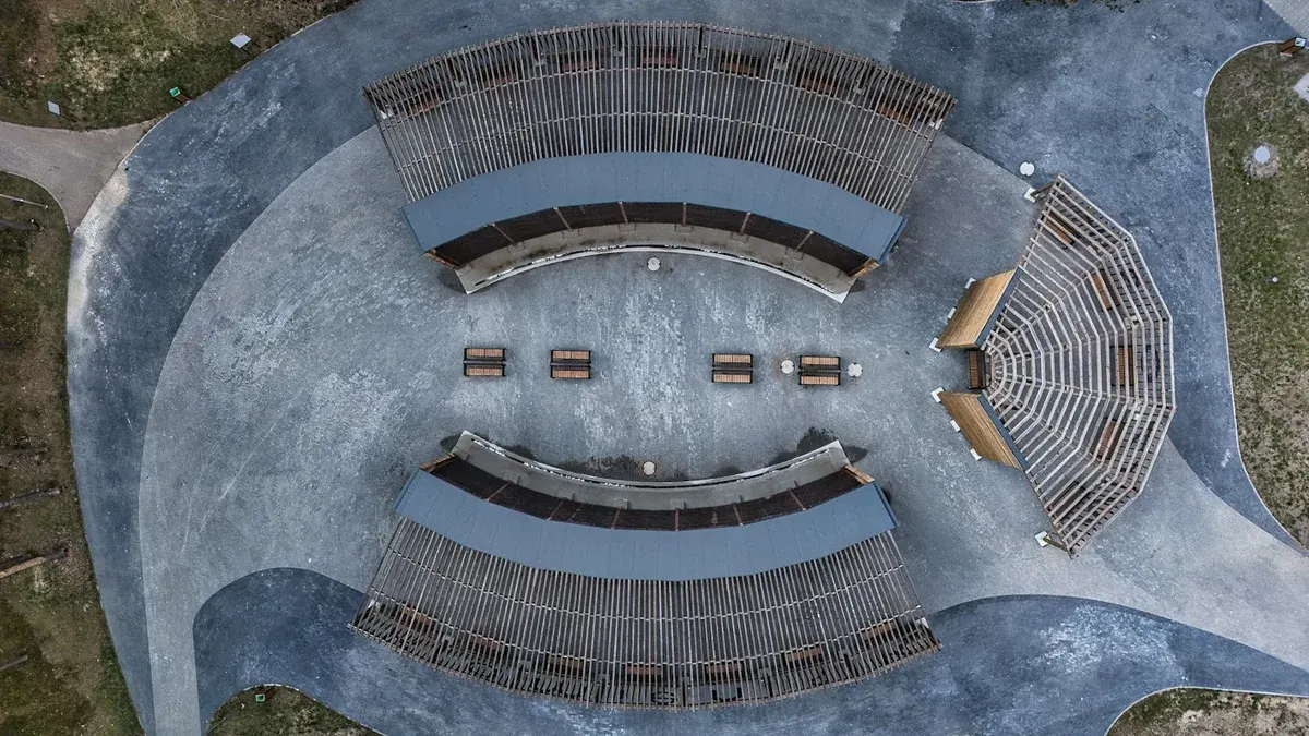
A park is a connected place. Paths lead to play areas, trees frame open lawns, drainage shapes low ground, and entrances connect the site to nearby streets. Aerial images can help a landscape team see these relationships at once. They can also create a dated record of construction or maintenance. The value depends on a clear question and careful planning around people, wildlife and the limits of the image.
This guide is for public agencies, landscape designers, contractors and park managers in India. It explains how to plan drone documentation from the first site record through development and later use. An aerial view can show visible change; it cannot by itself prove plant survival, water quality, legal boundaries or the safety of a structure.
Project Stage Selection & Honest Baseline Capture
Choose the project stage
A baseline before work serves a different purpose from a launch film after opening. The baseline may need complete coverage of existing paths, trees, structures, water and access. A construction report may focus on work packages and repeat views. A public film may use a smaller approved selection that helps residents understand the place. Name the stage and audience before the flight.
Write down the main questions. Which areas are being built? How will visitors enter? Where has planting been installed? Which paths remain closed? What changed since the last visit? These questions lead to useful views and captions. Without them, an attractive orbit may leave the maintenance team unable to find a particular feature.
Use the park's own zone names or create a simple grid. Give paths, gates, water edges, play areas and planting blocks stable labels. If a contractor or designer already has work package IDs, carry them into the photo index so the images can be discussed in ordinary project meetings.
Record the baseline honestly
Capture the park boundary as supplied by the owner, key entrances, surrounding streets, existing structures, visible vegetation and water features. State the date, season and recent weather. A dry-season view may make a waterbody look smaller; a wet-season view may hide a path or low area. Neither is the full annual picture.
If the project depends on an accurate area or level, commission a suitable survey and agree control and validation before treating a map as measured data. A visual drone mosaic can help people understand the site without establishing a legal parcel line. Keep the source of every boundary clear on the plan.
Mark places the camera cannot see. Tree canopy can hide a path. A wall may hide drainage work. A temporary enclosure can conceal part of a play area. Put these gaps in the report instead of presenting the image as complete coverage.
Plan around public use
An open park is not an empty work site. Walkers, children, vendors, maintenance crews and event visitors can move into a planned camera area. The park authority, site contact and pilot should review opening hours, likely activity, safe launch areas and a stop plan. A quieter window may help, but the pilot still has to assess current conditions before flying.
Identify no-film areas and neighbouring private space. A wide view can include homes, balconies, school grounds or vehicle plates outside the park. Change the angle or limit the public export where needed. Tell on-site staff about the capture so they can answer visitor questions and help manage access without turning the shoot into an unexpected event.
Wildlife matters too. A water edge, tree canopy or quiet habitat may have birds or other animals. The local site team should identify sensitive areas and times. If a proposed flight would cause disturbance, use a different time, viewpoint, ground image or existing data. The documentation goal does not justify a poor operating choice.
Landscape Visual Documentation Standards
Capture the layout and the detail
Use wide views to show the relationship between gates, paths, planting, water and surrounding roads. Then use closer views for features that the project team needs to locate. A small sapling may be invisible in a site-wide image. A close image of a planting bed may be hard to place without the overview. Pair the two and label them with the same zone ID.
For construction progress, choose repeat viewpoints at the start. Record the camera direction and approximate position. A future view may not match perfectly after trees grow or structures are added, but a reference makes the comparison more honest. Do not replace an obstructed view silently with an unrelated angle.
For public communication, use shots that explain how someone will actually use the park. Show the real entrance, accessible routes and finished amenities that can be represented accurately. Ground-level video may explain seating, play equipment or path surfaces better than the drone. A balanced package need not force every detail into an aerial frame.
Keep completed and proposed work separate
Landscape plans often show a mature result years before the site reaches it. A newly planted area may look sparse from above. A proposed water feature may still be a construction pit. Date images and label current work plainly. If the team adds a design overlay, make it clear which layer is proposed and which is a photograph of existing conditions.
Avoid implying that a path is open when barriers remain. Do not crop away active work to make a partly finished zone appear complete in an operational report. A selective promotional image may have a different purpose, but its caption should still reflect the actual stage of the park.
After opening, seasonal change can make an area look greener or drier without any change in maintenance quality. Record season and weather alongside any comparison. Ecological or horticultural conclusions need field data and an expert assessment, not just a visual impression from one date.
Build a practical progress report
A short report can begin with the capture date, zones covered, visible changes and gaps. Follow with paired images by zone. Use concise captions such as “east path surface visible from Gate 2 to the bridge” instead of “major progress achieved”. The latter may be true, but it needs a defined measure if it will be used as a formal progress claim.
Give observations an ID and link to the original image. If the image shows a blocked path or exposed area, list the person who should review it. Do not turn an aerial observation into a safety certification. The engineer, contractor or park authority makes that decision through its own process.
Include a coverage table. It should state which zones were photographed, which were hidden or not available, and whether a return visit is needed. A good report makes its blind spots easy to find.
Post-Opening Maintenance & Handover Checklist
Use the record after opening
A park manager can use repeated views to locate a damaged path, compare a water edge or see whether a planted area has changed visibly. Keep the same zone IDs and archive the earlier images. A maintenance request can refer to an image and date rather than a vague description such as “near the far gate”.
The image is a starting point for inspection. Aerial views may show a fallen branch or an obstructed drain, but they may miss a small trip hazard under a tree or the condition of an equipment fixing. Ground checks remain essential. Record when an issue was inspected, repaired and verified so the photo archive feeds real work.
Agree how often new capture is useful. A construction project may need milestone records. A mature park may only need a seasonal or issue-led update. Frequent flights without a question create a large archive that nobody has time to review.
Approve public images separately
The client may use selected views for a website, a public meeting or a social post. Review visitor privacy, neighbouring property, project stage, map labels and any claim about opening or accessibility. Keep the full technical record with controlled access and place only approved files in the public folder.
If a design render is placed over a photograph, label it as a visualisation. If an image was taken before planting grew or before a path opened, keep the date visible where it matters. Accurate captions build trust in a public project.
Public park project handover checklist
Deliver dated originals, an image index, a zone map, selected labelled views, a report if requested, and a clear limitations note. Check that the client can open the files and locate a named feature. Separate source images from edited marketing versions. A useful park record helps the team understand space, explain change and plan its next visit while leaving ecological and engineering judgments to the people and evidence suited to them.
For wider context, see the urban planning guide and privacy guide.
Plan your project
Share your site, dates and intended output so we can confirm a suitable scope.
Environmental & ESG Monitoring · Compare project scope · Get in touch
Related reading
- Floodplain Drone Mapping and Water-Risk Documentation in India
- Heritage and Monument Drone Photography in India: Documentation Guide
- Urban Lake Restoration Drone Monitoring in India: Documentation Guide
- Architecture Competition Drone Photography in India: Submission Guide
- Corporate Annual-Report Drone Photography in India: Planning Guide
- Commercial Rooftop Solar Drone Documentation in India
Contact SkyViews Aerial Drone Studio at +91 90190 56479 or skyviewsdronestudio@gmail.com. Service area: Bangalore, Karnataka and India and wider Bangalore, Karnataka and India.