Construction Crane and Vertical Progress Drone Photography in India
How construction teams can document cranes, high-rise structure, facade progress and vertical milestones with safe repeatable aerial imagery.
By SkyViews Aerial Drone Studio
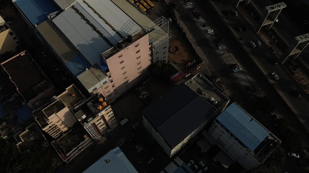
A high-rise project changes vertically as well as across the ground. A ground photograph may show the entrance but hide the upper facade. An aerial view can place towers, crane positions, material zones and surrounding roads in one frame. It can also show a specific level from a useful angle. The camera must be planned around a live construction site where lifts, workers and equipment take priority over filming.
This guide is for project teams in India using drones to document cranes and vertical progress. It explains how to define a milestone, coordinate the flight, repeat views and report what is visible. A drone image is dated evidence, not a certificate of slab quality, structural completion, crane safety or contract progress.
Vertical Progress Criteria & Baseline Views
Define what the report must show
Start with the project's own block and tower IDs. Decide whether the report is about structure, facade, roof, crane setup, access or a specific milestone. A vague request for “construction progress footage” can produce dramatic images without answering a manager's question. A useful brief might ask for a consistent view of Tower B's east elevation and the podium work area on each monthly visit.
Identify the reader. A site manager may need a marked-up record of visible work. An investor may need a short, accurate summary. A marketing team may want a clean edit. Keep the factual source set distinct from the public version so selective film shots do not replace the operational record.
List what must not be filmed. Draw the project boundary, active lifting zones, neighbouring properties and any security-sensitive area on a plan. The pilot and site controller can then review where a view is possible and where another method is needed.
Set a baseline for vertical comparison
Choose reference viewpoints that show the tower from more than one side. A wide image helps locate blocks in the site. A closer elevation view helps a reviewer compare visible levels and facade work. Record approximate camera position, direction, date and tower ID. Use the same labels each month.
The site may change enough to block a viewpoint. A new tower or crane can obstruct the old line of sight. When that happens, keep the old view history, label the new view and explain the change. Do not present two different angles as a precise before-and-after pair.
Capture ground context too. Access roads, temporary works, material staging and site boundaries often explain why vertical work is proceeding in a particular sequence. A photograph of only the top of a tower may hide the logistics that the project manager needs to discuss.
Crane Coordination & Facade Integrity Checks
Coordinate with crane operations
Crane work is not background action for a video. The site controller must tell the crew about planned lifts, swing areas, load paths, work fronts and times when filming is not suitable. The pilot should not rely only on a schedule from the previous day; activity can change before take-off. Everyone needs a communication and stop plan.
Do not assume a flight is feasible near a crane just because another drone flew there earlier. Equipment configuration, site layout, wind, visibility and people on the ground can differ. The pilot makes the final operating decision from current conditions. If a requested view conflicts with a lift or safe separation, the view should be moved, delayed or omitted.
Brief the crane team, safety contact and relevant contractors. A camera crew should not enter a work zone or ask an operator to repeat a lift for a shot without the site's authorised process. A planned quiet window may give the best view of the structure, while a lift-day record needs a separate, carefully approved purpose.
Check the whole flight area
High-rise sites have edges, cables, temporary structures, moving vehicles, workers and neighbouring buildings. The pilot and site contact should inspect the proposed launch and recovery area and the full camera route. A safe take-off point does not make the path around a tower safe. Weather can change with height and between buildings.
Identify public roads and occupied neighbours that may appear in the frame. Choose angles that avoid unnecessary capture of private balconies, windows and people. If the project needs a broad city context shot for marketing, review that use separately from the technical progress set.
Keep a fallback shot list. If the planned elevation view is blocked, an approved ground or fixed-camera image may answer part of the question. Mark the substitution in the report. A missing aerial view should not be silently replaced by a different perspective.
Photograph structure and facade honestly
Use stable, readable frames for progress. A slow wide view can show the overall tower stage. A closer still can show the visible facade or roof area. Include enough surrounding floors for orientation. An extreme crop can make a level look complete when adjacent work remains open.
Label what is visible. “East facade panels visible through Level 18 on capture date” is an image observation. “Facade package complete” may depend on inspections, hidden fixings and contract records. The project team should verify any completion claim before it appears in an investor or sales update.
The same applies to the structural frame. A visible slab does not prove dimensions, reinforcement, concrete quality or acceptance. If the team needs measured progress, define a suitable survey and checking method. Do not estimate contractual quantity from an oblique marketing photograph.
Repeatable Reporting & Milestone Archive
Use a repeatable reporting sequence
Organise each visit by project overview, tower, elevation and work zone. Give every key view an ID. Save original images and the annotated report. A manager should be able to open the source file behind a marked-up observation. This helps resolve questions when a caption is unclear.
Include dates and weather. A shadow, scaffold or safety net can hide a facade. A rain-soaked surface may look darker than the prior month. Note limits that affect comparison. If one tower was not captured because of lifting, state that in a coverage table rather than leaving a blank cell.
Keep an open-items list. An image may show a temporary material stack near an access route or an unfinished-looking zone. The site manager decides whether it is expected work or an issue. The report can assign a check and link the answer later. It should not make safety findings outside the agreed professional scope.
Plan marketing separately from the progress record
A public film may use sunrise light, elegant movement and a short story of the skyline. A progress report needs consistent views, dates and limits. Both can be made from one approved visit, but they should not be confused. Keep public selects in a separate folder and check every caption about completion, amenities and possession against the developer's verified information.
If a time-lapse or before-and-after sequence is planned, align frames carefully and show the dates. Do not use speed or editing to imply that work happened continuously or faster than it did. A short visual story can still be accurate when the intervals and scope are clear.
Deliver a file set the next team can use
Agree whether the output includes stills, video, a monthly report, source files, model or map. Specify formats, version names and archive access. Keep tower IDs and view IDs in filenames or the index. A new contractor should be able to find an earlier east-elevation view without guessing which file from a large camera folder it was.
Check the file set before closing the visit. Open a sample, confirm dates and labels, and compare the report's links with the originals. If a model or measured surface is included, state its survey method and limits. Do not let a visually polished 3D product imply an accuracy that was not checked.
Example: two towers and a podium
Suppose a project has Towers A and B above a shared podium. The monthly plan has one site overview, two reference views of each tower and one podium view. On this visit, active lifting blocks Tower B's north view. The report shows the other images, notes the missed view and labels the visible facade changes. It does not state that Tower B is complete. The site manager links the aerial record to formal progress and inspection data before issuing a milestone update.
That process yields a useful visual history without turning the drone into a substitute for construction control. The crew knows when to stand down; the reader knows exactly what the images show; the project retains source files for later review.
Plan your project
Share your site, dates and intended output so we can confirm a suitable scope.
Construction & Infrastructure · Compare project scope · Get in touch
Related reading
- Construction Drone KPI and Progress Reporting Guide for India
- Construction Drone Progress Monitoring in Bangalore: A Practical Guide
- Aerial Progress Documentation for Construction Sites
- Property-Management Aerial Audits in India: Recurring Drone Documentation
- Industrial Tank Drone Inspection in India: Visual Planning and Reporting Guide
- Earthwork Quantity Handover with Drone Survey in India
Contact SkyViews Aerial Drone Studio at +91 90190 56479 or skyviewsdronestudio@gmail.com. Service area: Bangalore, Karnataka and India and wider Bangalore, Karnataka and India.