Construction Drone KPI and Progress Reporting Guide for India
How project teams can turn recurring aerial capture into useful progress indicators without confusing visual evidence with contractual...
By SkyViews Aerial Drone Studio
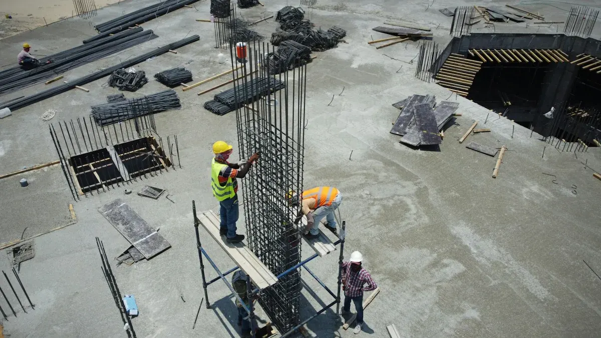
A recurring drone programme is most useful when it answers the same project questions each cycle. A report can show visible work fronts, milestones, access, stockpiles, safety observations and change, but the KPI definitions must be agreed with the project team.
Choose useful indicators
Examples include visible work-front status, completed slabs or roads, excavation zones, stockpile context, access changes, structure height or area references and photo coverage. Do not claim a percentage complete from an image unless the project’s measurement method supports it.
Standardise capture
Use a defined boundary, repeatable viewpoints, dates, asset labels, weather notes, report sections and file naming. Record inaccessible zones, changed viewpoints, obstructions and unusual site conditions so the comparison remains honest.
Link evidence to the report
Every observation should connect to an image, clip, map page or model. Separate visual evidence from contractor certification, billing measurement, safety sign-off and engineering conclusions.
Share the right version
Executives may need a short dashboard or film. Site teams may need annotated stills. Survey or engineering teams may need mapped outputs. Define audience-specific deliverables instead of sending one oversized folder to everyone.
Define each indicator before the first flight
A useful KPI has a name, an owner, a time period, a method and a source. “Road progress” is not enough. The site team might mean visible paved length, a certified quantity, or the number of road sections handed over. A drone can show the surface and context, but it cannot read hidden layers or decide that the work passed inspection. Put the agreed definition in a small KPI sheet and state which parts the imagery can support. If the team changes the definition later, keep a record of the change instead of silently replacing earlier figures.
For each item, write the question the report should answer. “Which blocks had visible external work this week?” can be answered with dated views. “How much concrete was accepted?” needs site records and the responsible certifier. “What changed near the north gate?” may need a matched pair of images. This distinction helps the project manager avoid paying for mapping when a simple visual record is enough, or relying on photographs when measured data are needed. Construction KPI guidance from the UK government likewise treats indicators as defined measures with stated methods, rather than free-form impressions (KPI definitions).
Build a baseline the team can trust
Before recurring capture begins, record the project boundary, work-package names, drawing revision, capture date, site conditions and the list of agreed viewpoints. Link each viewpoint to a location or grid so another pilot can repeat it. A baseline should show the site as it was, including unfinished or blocked areas. A glossy highlight video may be useful for communication, but it is a poor sole baseline because it skips inconvenient views and may mix footage from different days.
Agree on how to handle design changes. If the earthwork boundary expands, label the new area rather than comparing it with an earlier image that did not cover it. If a crane blocks a camera position, take the nearest safe substitute and note the change. Keep original images with capture dates and a simple shot log. The report's selected frames should point back to these files. This makes a later question about a caption or missing area answerable.
Report visible status by work front
Divide the site into areas that the team uses in meetings: towers, blocks, roads, yards or packages. For each area, list the planned observation, actual visible status, image references, limits and next review date. A status such as “roof sheeting visible on blocks A and B” is clearer than “roof works 80% complete” when there is no agreed measurement. When a quantity is available from the contractor's system, name that source and keep it separate from the drone observation.
Use one report row per meaningful change. If nothing visible changed, say so rather than searching for a dramatic angle. On a busy site, a work front may be active indoors and look static from above. Add a field for “outside drone view” so the aerial report is not mistaken for a full project report. A project manager can then combine it with schedule, quality, safety and commercial records.
Choose a sensible cadence
Weekly flights may make sense during fast earthwork or roof installation. Monthly visits may be enough for a slow phase. Set the cadence around decisions: progress meeting, lender update, contractor coordination or public communication. Too many visits can create files without new insight. Too few can miss a temporary condition such as drainage blockage or a changed access route. Review the cadence after a few cycles using the questions that people actually asked of the report.
Keep a consistent reporting cut-off. If the report says “May progress,” state the capture date and the period represented. Do not combine one block filmed on Monday and another on Friday into a single apparent snapshot without noting it. Rain, dust or restricted access may defer a view; the report should show the gap and whether a later visit filled it. A short gap note is more credible than an unlabeled old image.
Link the dashboard to evidence
A dashboard tile should open or reference the underlying image, map or site record. For each status, include an asset ID, date, viewer-friendly caption and reviewer. Keep labels stable across cycles. If a chart uses a percentage, show the calculation method, numerator, denominator, data owner and revision. A photograph should never quietly become the sole basis for a financial or contractual number. The monthly progress report template can help lay out the visual pages.
Use a traffic-light flag only with agreed meanings. For example, red might mean “ground review needed within this reporting cycle,” not “asset unsafe.” A site safety observation needs the company's safety process, a clear notification route and a qualified reviewer. Do not present a drone operator's visual note as a formal safety finding. The same care applies to a suspected drainage problem or stockpile change.
Example: a mixed building and road project
Imagine a site with two buildings, an access road and a material yard. The first visit records four named work fronts and six repeat views. On the next visit, the drone shows new roof cover on Building A, visible grading on the road and a changed yard layout. Building B looks unchanged from above. The report records those observations with frame references and notes that internal services are outside aerial view. The contractor's schedule remains the source for milestone dates and certified quantities.
At the progress meeting, the team asks whether the road is ready for heavy vehicles. The aerial report can show the visible surface and access route, but the site engineer checks the road build-up and acceptance records. The team also asks for a short investor update. The project manager approves three dated images and a caption that says exactly what is visible. The detailed yard images stay in the internal report because they show operations the owner does not wish to publish.
Separate audiences and permissions
The site team may need high-resolution originals and marked work fronts. Executives may need a one-page summary. A lender or investor may need a verified milestone narrative with dates and limits. Marketing may need a short film. Set a recipient list for each output and have an owner approve public use. Drones can capture workers, neighbouring homes, security arrangements and contractor methods. Remove or restrict material that the audience does not need.
Keep a report register with issue date, version, reviewer, recipient and corrections. If a caption was wrong, issue a corrected version that points to the earlier one; do not let two conflicting “final” reports circulate. Make it easy for the site team to flag a wrong asset label or outdated schedule note. This is part of making the KPI programme useful, not an extra administrative layer.
Review the programme after three cycles
Ask which report pages led to action, which images nobody opened and which questions remained unanswered. Remove weak indicators and add only those with a clear owner and method. Check whether viewpoints can still be repeated safely, whether the site boundary changed, and whether the selected cadence matches construction speed. A good recurring programme becomes shorter and more precise as the team learns what matters. Its value is clear evidence for decisions, not the number of photographs delivered.
See the construction case-study template and monthly report template.
FAQs
Can drone imagery calculate percentage completion?
Not by itself. A project-specific measurement method and responsible team must define how completion is calculated.
Can the same viewpoints be used every month?
Yes. Repeatability is valuable, provided changes, obstructions and safety-related exclusions are recorded.
Can progress reports be shared with investors?
Yes, after the project team verifies captions, confidentiality, visible status and the limitations of the imagery.
Plan your project
Share your site, dates and intended output so we can confirm a suitable scope.
Construction & Infrastructure · Compare project scope · Get in touch
Related reading
- Construction Crane and Vertical Progress Drone Photography in India
- Construction Drone Progress Monitoring in Bangalore: A Practical Guide
- Aerial Progress Documentation for Construction Sites
- Chimney and Industrial Stack Drone Inspection in India: Planning Guide
- Thermal Building-Envelope Drone Inspection in India: Scope and Limits
- Lender and Real-Estate Drone Due Diligence in India: Visual Review Guide
Contact SkyViews Aerial Drone Studio at +91 90190 56479 or skyviewsdronestudio@gmail.com. Service area: Bangalore, Karnataka and India and wider Bangalore, Karnataka and India.