Apartment Handover Drone Documentation in Bangalore: Practical Guide
How developers and resident associations can document external buildings, landscape, roads, amenities and visible completion before handover.
By SkyViews Aerial Drone Studio
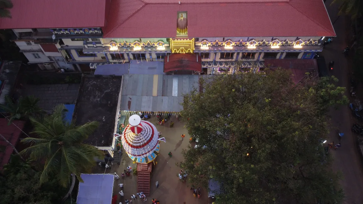
The last stage of an apartment project is busy. Contractors finish external work, residents begin moving in, and the developer prepares records for the association or facilities team. A dated aerial record can help everyone see the layout and visible condition of the common property at a chosen point in time. It can also show which areas were still under work when the images were made.
The record has a clear limit. A photograph of a finished-looking building cannot certify that the roof is sound, the fire system works or the legal handover is complete. This guide explains how a Bangalore apartment project can plan useful drone documentation while keeping those claims separate.
Decide who will use the images
The developer may need a visual summary for the handover meeting. The resident association may want a dated archive of the buildings, landscape and access routes. The facilities team may need orientation views for later maintenance. A marketing team may want a short overview after the property is ready for public presentation. These audiences need different levels of detail and review.
Write down the main purpose before the shoot. A handover archive should favour clear, repeatable views and labels. A marketing video may favour a short visual route through the campus. A snagging support set needs close views of a named area, but a drone image alone may not show the defect well enough to support a repair decision. Keep these outputs separate so a polished film is not mistaken for a complete condition record.
Identify every block, common area, road, gate, parking entrance and amenity by the same names used in the project plan. If the project has phases, label them clearly. An image called “Tower A north roof, 18 October” is far more useful six months later than a file called “final drone 4.”
Make a site map and shot list
Start with a current site plan. Mark the apartment blocks, clubhouse, play areas, landscape, internal roads, pedestrian routes, drainage features, boundary wall, parking ramps and visible service areas. Circle any area that should be recorded before access changes, such as a temporary construction gate. Mark no-film areas and neighbouring properties that may enter the frame.
For each area, state the needed view. A wide overview can explain how the campus is arranged. An oblique view can show the relationship between a tower and its landscape. A top-down view may help locate visible roof equipment or paving, but it is not automatically a survey. A ground photo may be better for a door, drain cover, crack or material finish. Use the method that actually shows the item clearly.
Agree the image list with the developer and the receiving association or facilities representative where possible. A short joint review prevents a common gap: the team films the impressive facade but misses the service road or rainwater area the maintenance team needs to understand.
Record the date and project state
Every image should have a capture date. The cover page should say whether the property was occupied, partly occupied or still under construction on that date. If an amenity was closed or a block remained under work, state that in plain words. Do not crop out unfinished work and then describe the whole project as complete.
Plan the capture around a specific handover milestone. If the property changes after the flight, a later report should carry its own date and not silently replace the first record. A before-and-after pair can be valuable for landscape planting or road completion when both dates and viewpoints are clear. Record any difference in light, weather or angle that affects comparison.
Use neutral captions. “Paving visible along the east path” describes an image. “Path completed to specification” requires inspection and project records. “Pool area visible behind the clubhouse” is safer than “pool ready for use” if water treatment, access controls or approvals are outside the image.
Coordinate an occupied or partly occupied site
Apartment complexes are private living spaces. Ask the site or association contact about residents, children, staff, moving vehicles, balconies, windows and common-area activity. Choose a time and route that fit the approved plan. The drone operator must review current airspace, weather, take-off options and site safety for the exact location. A past flight elsewhere in Bangalore does not establish that this one is feasible.
Tell the relevant site team what areas are being documented and who will receive the output. A simple notice may help residents understand the activity, but it does not replace permissions or privacy planning. Avoid hovering near balconies or windows to obtain a closer view. If a requested inspection needs close capture, it should be separately scoped with the property manager and a competent inspector.
Construction may still be active. Cranes, scaffolds, temporary cables, workers and delivery trucks affect both the flight and what the image means. The site contact should identify ongoing work and restricted zones before the crew arrives. The operator should be able to postpone or change the plan if conditions differ on the day.
Capture exteriors in a consistent order
A useful handover sequence starts with one campus overview, then moves through each block in a fixed order. Show the primary gate and roads, landscape, amenities and boundary. If the project has several towers, give each one a small set of comparable views. Record roof areas only when the angle and distance provide meaningful detail without entering private views.
Repeat points matter if the team plans later maintenance or warranty records. Give each viewpoint an ID and description, such as View 05: south gate toward Towers B and C. Save the approximate position, height and direction. Future captures may still differ because of access or weather, but the reference sheet will make a reasonable comparison possible.
Use still photographs for the archive. A video may help tell the story, but a reviewer often needs to pause, zoom, label or cite one frame. Deliberate stills are easier to place on a plan and to compare later. Keep the original files and selected copies separate.
Use the record for visible follow-up items
An aerial image can flag a visible condition for closer review: an open patch of paving, debris in a common area, uneven-looking landscape coverage or a temporary structure left near a road. Give the item a location, date and image number. Then send it to the responsible project or facilities person for ground inspection. The image should start a question, not close it.
Do not use a drone photograph alone to assign fault to a contractor or confirm a legal defect. Perspective, shadow and image resolution can make a surface look different from the ground. Some items are hidden by parapets, trees or parked vehicles. A report should have a “not visible or not assessed” section so readers know where the aerial record ends.
The receiving team may find a simple annotated plan more helpful than a long film. Put a small marker on the plan for each selected photograph. Keep annotations on copies, preserve clean originals and avoid arrows that hide the detail being discussed.
Separate the archive from public marketing
The internal archive may include roof details, entry layouts, vehicle plates, residents or nearby properties. Those images should have controlled access. A public handover story should be reviewed for privacy, security, accuracy and rights before release. It may use wider views and fewer labels than the facilities version.
Agree who owns and approves each version. A resident association may receive a selected set rather than every raw flight file. Put the delivery terms in the brief: source images, edited images, video, resolution, file format, access method, retention period and any permitted reuse. This avoids a later dispute about whether “all photos” meant every original frame or the approved selection.
If the public copy mentions completion, opening or readiness, check those words against the formal project documents. The image can support a dated visual story, while certificates, approvals and agreements establish the status of handover.
Prepare a handover package people can find later
A practical package includes a one-page index, site plan, capture date, block names, selected stills, short captions and a list of limits. Number each image and use stable filenames. Store source material and final approved versions in different folders. Give the facilities team the contact and process for requesting a later comparison capture.
The final note should explain what was not filmed because of privacy, site access, safety or unfinished work. It should also direct technical questions to the correct inspection or legal record. For follow-up on roof and facade conditions, use the apartment inspection guide. For planning future property updates, see the property content calendar.
FAQs
Can aerial images prove an apartment project is handed over?
No. They document visible conditions on a stated date. Contractual, legal and technical handover follows the project's formal documents, checks and approvals.
Can residents receive the original photographs?
That depends on the agreed scope, privacy review and usage rights. Decide before capture which originals or selected files the association will receive and how they will be stored.
Can unfinished amenities be shown?
Yes, when they are labelled clearly as under work or unavailable on the capture date. Public use should be approved in context so viewers are not led to believe the amenity is already open.
Plan your project
Share your site, dates and intended output so we can confirm a suitable scope.
Aerial Imaging & Cinematics · Compare project scope · Get in touch
Related reading
- Data Centre Exterior Drone Documentation in India: Security-Conscious Guide
- Drone Land Due Diligence and Site Documentation in Bangalore: Buyer Guide
- Drone Photography for Architects: Portfolio, Project and Design Documentation Guide
- Farmland Drainage and Irrigation Drone Mapping in Karnataka
- Public Park and Landscape Development Drone Documentation in India
- Architecture Competition Drone Photography in India: Submission Guide
Contact SkyViews Aerial Drone Studio at +91 90190 56479 or skyviewsdronestudio@gmail.com. Service area: Bangalore, Karnataka and India and wider Bangalore, Karnataka and India.