Data Centre Exterior Drone Documentation in India
How data centres and critical facilities can plan controlled aerial imagery for construction, external assets, landscaping and corporate...
By SkyViews Aerial Drone Studio
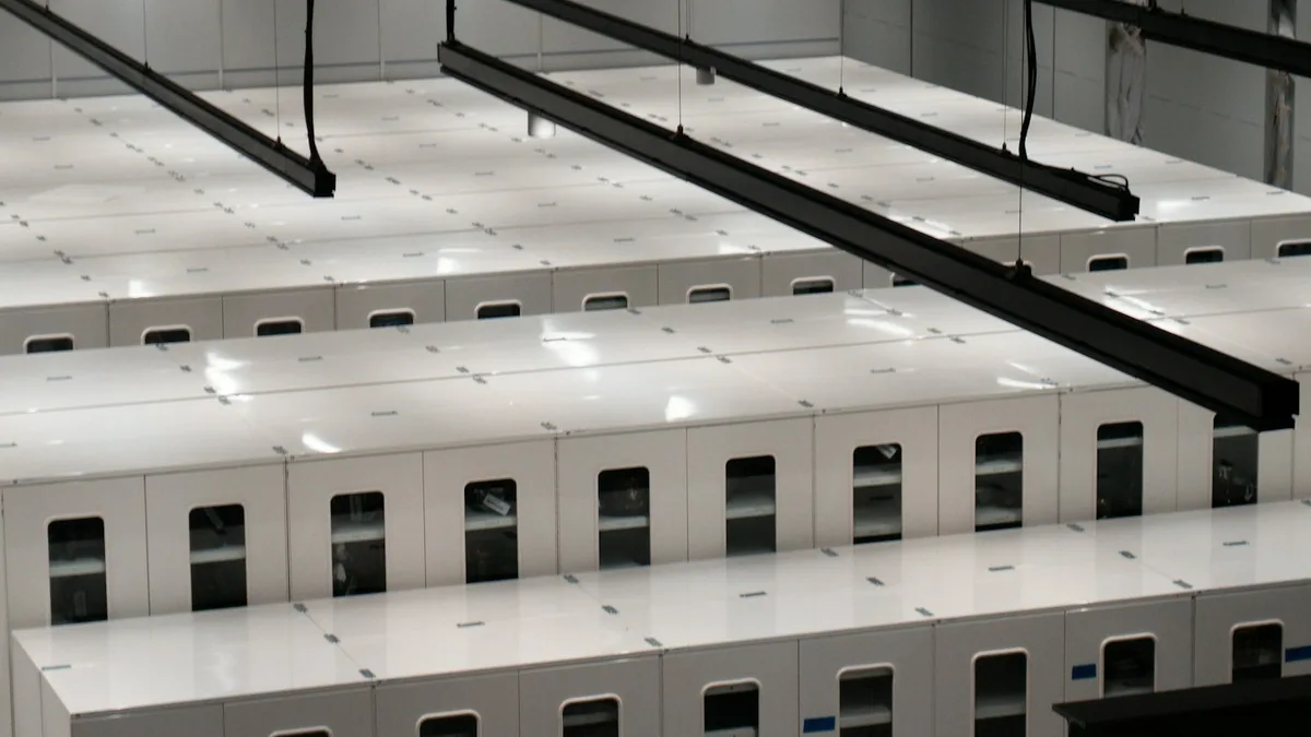
Data-centre imagery requires a stricter brief than normal commercial property photography. A project may need construction progress, roof and facade documentation, landscaping, access context or a corporate film, but aerial views can also expose sensitive security and operational information.
Define what may be shown
Mark the building, external assets, expansion area, access road, landscaping and no-film zones. Confirm whether logos, equipment, entrances, vehicle plates, security systems, neighbouring properties or roof details may appear in the public version.
Coordinate facility controls
Nominate security, facilities and communications contacts. Confirm access, induction, site safety, take-off area, visitor levels, power systems, restricted areas and the approved capture window. Keep an operational record separate from a marketing edit.
Limit and review the data
Capture only what the brief needs. Review all source and edited material for sensitive details before release, control downloads and state the archive period. A polished film can still disclose information through background context.
Choose the deliverable
Construction records may need repeatable views and annotated comparisons. Marketing may need a brand film and social cuts. Facilities may need a controlled visual record. These should be separate scopes with appropriate access and approval.
Decide the audience before the shot list
An internal facilities report, a contractor progress record and a public corporate film should not start from the same assumption about detail. Facilities may need clear views of roof zones and external plant. A construction team may need repeat viewpoints of a new building wing. A public film may only need a broad view of the campus and landscaping. Ask who will see each output and what decision it supports. The answer sets the distance, direction, file detail and review process.
Make a simple two-column list: “needed in the private record” and “permitted in public media.” Some views may be in neither column. For example, a close view of a controlled entrance might add little to the construction question and disclose more than the facility wants. A careful brief avoids collecting such footage in the first place. If a public film needs a data-centre story without revealing site layout, approved interior graphics, staff interviews or generic process visuals may be more useful than a low pass around the building.
Walk the location with security and facilities
Ask for a current site plan with the approved crew route, check-in point, launch and recovery areas, no-film zones, active construction and emergency contact. A normal contractor pass may not cover a drone flight or a camera looking down on secure areas. Confirm which vehicles, contractors and visitors will be moving during the capture window. Decide who can stop the shoot at once if operations change. The pilot also checks current airspace, weather, obstacles, people and a safe path back to the launch point.
Keep the site plan itself in controlled storage. Do not attach a full security drawing to a general marketing brief. A minimal marked map can tell the crew where to work without distributing more facility information than needed. If the site has a roof or facade view that cannot be captured without showing sensitive assets, discuss a ground-based alternative or a tighter frame before the flight day. A reshoot after a failed security review is expensive and may still expose the same details.
Capture a useful construction baseline
For an expansion project, list the work areas in the terms used by the project team: new hall, plant yard, access road, drainage or landscape zone. Take a dated wide view of each area and a small set of repeat views. Record where the camera stood or flew, its direction and any blocked area. On the next visit, use similar positions where safe. A comparison should say what is visible, what changed and what remains outside the view. It should not declare a hall commissioned or a power system complete from an external photograph.
Internal construction evidence may show contractors, deliveries or temporary systems. The project team should define the retention and sharing rules for those files. A public update can use a reviewed selection with a caption approved by the project owner. If the schedule changes, keep the capture date on the asset and remove claims that no longer describe the project. The construction KPI guide explains how to keep visible progress separate from certified milestones.
Treat roof and facade images as evidence, not diagnosis
A drone can show visible damage, staining, missing panels, blocked drains or changed equipment positions from an accessible external view. It cannot see inside a roof, test a waterproofing layer, verify electrical condition or prove the cause of a temperature pattern. Record the building zone, image reference, date, view direction and any obstruction. Send suspected issues to the appropriate facility engineer or contractor for a closer check. Avoid public captions that turn a visual observation into a safety conclusion.
For repeat condition work, use stable area labels and comparable views. A shadow, wet surface or new temporary item can look like a change in material condition. Keep originals and a short conditions log. If a sensitive roof system is needed for maintenance, provide the image in a restricted report. It should not be copied into a marketing edit by default. The inspection report guide gives clients a way to read observations and limitations.
Inspect the background of every frame
The main building may be approved for filming while the background is not. Zoom into gate controls, security cameras, badge stations, roof layouts, vehicle plates, neighbouring property and staff faces during review. High-resolution originals can reveal details that are not obvious on a phone preview. Ask whether geolocation metadata, file names and timestamps should be removed from public exports. Keep the source archive untouched in a restricted location and create separate approved derivatives for release.
Set an approval chain before editing: facilities checks technical context, security checks exposure, and communications checks public wording and brand use. The person approving a pretty image may not know what a small roof detail means. A written sign-off on the final export and caption reduces that gap. If the facility asks for a change, issue a new version and retire the old one from shared folders. The commercial data-security guide covers delivery and retention questions in more detail.
Make the public story modest and accurate
A corporate audience may need to understand the organisation's scale or a new building's external form. Use approved wide views, landscaping and controlled staff scenes. Avoid claiming resilience, uptime, energy performance or capacity from an aerial image. Those claims need verified operational evidence from the company. If a facility is under construction, label it as such. Do not mix an older finished-building view with a current expansion view in a way that suggests the whole campus is already complete.
The edit can be effective without showing every asset. A short sequence may include the approved entrance, a high-level exterior, landscaping and an interview or graphic. Text can explain the service while the visuals provide context. This often answers the marketing question better than a technical roof tour. Agree on the website, investor, recruiting or social channels before export, because each channel may have different crop and disclosure concerns.
Example: documenting an expansion wing
Suppose a facility is adding a second building. The project manager needs monthly exterior records, and communications wants one image for an annual report. Security marks the gatehouse, roof equipment and adjacent tenant area as no-film zones. The pilot and facilities lead agree on four repeat viewpoints from approved locations. The first report shows cleared ground and access works. A later report shows the outer structure and notes that interior fit-out is outside the camera's view.
The annual-report team requests a wide frame. Security reviews the full-resolution original and approves a crop that removes the gatehouse and adjacent roof. The project manager approves a caption saying the wing is under construction, with the capture date. The internal record keeps all allowed evidence under restricted access. One planned visit supports both purposes because the team decided in advance which details belonged in each output.
A client checklist for the first call
Provide the exact site, purpose, audience, priority building zones, expected dates and no-film areas. Name the security, facilities and communications reviewers. Ask the crew to explain safe launch options, flight feasibility, how it will minimise capture, where originals will be stored, who can download them and when they will be deleted or archived. State whether ground cameras or approved stock footage can replace restricted aerial views. The result should be a small, controlled set of useful evidence, not a large archive with no clear owner.
FAQs
Can data centres be filmed by drone?
Possibly, subject to owner approval, security, site safety, equipment, weather, privacy and current flight-feasibility review.
Can roof equipment be shown publicly?
Only if the facility approves it. Sensitive technical or security details should be excluded or kept in a restricted handover.
Can construction progress still be documented?
Yes, with a repeatable, controlled capture plan and a publication review that separates operational data from public marketing.
Plan your project
Share your site, dates and intended output so we can confirm a suitable scope.
Aerial Imaging & Cinematics · Compare project scope · Get in touch
Related reading
- Real-Estate Investor Data-Room Drone Visuals: Documentation Guide
- Apartment Handover Drone Documentation in Bangalore: Practical Guide
- Drone Land Due Diligence and Site Documentation in Bangalore: Buyer Guide
- Post-Flood Drone Damage Assessment for Infrastructure in India
- Apartment Society Roof and Facade Drone Inspection in Bangalore
- School and College Campus Drone Photography in India: Planning Guide
Contact SkyViews Aerial Drone Studio at +91 90190 56479 or skyviewsdronestudio@gmail.com. Service area: Bangalore, Karnataka and India and wider Bangalore, Karnataka and India.