Industrial Drone Inspection Report Template
A practical reporting framework for roof, facade, solar, stack, yard and external-asset drone inspections at factories and logistics facilities.
By SkyViews Aerial Drone Studio
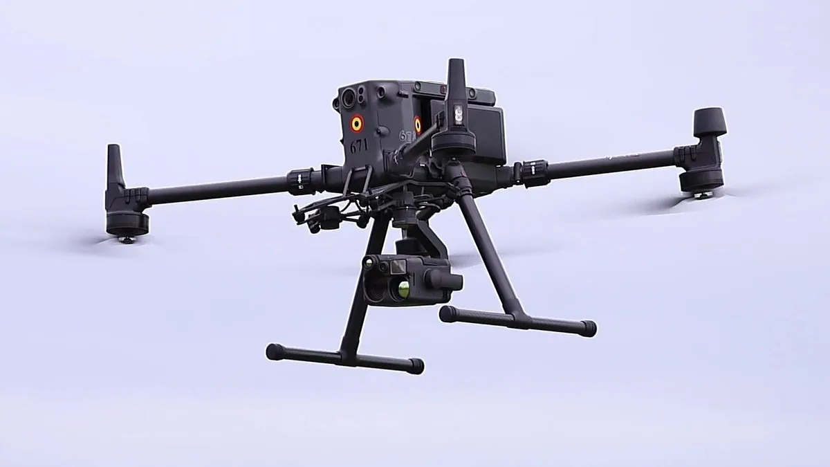
An industrial drone inspection report should make it easy for a maintenance or engineering team to understand what was inspected, when it was inspected, what was visible, what was not visible and what follow-up is needed. It should not turn an aerial image into an unsupported engineering conclusion.
Report cover and scope
Record the facility, asset or zone, inspection objective, date, client contact, weather, aircraft and payload, approximate capture area and the requested output. State whether the assignment is visual documentation, defect triage, thermal screening, maintenance planning or a survey/mapping task.
Asset register
Give each roof section, facade elevation, stack, tank, solar block, pipe rack or yard zone an identifier. Use the same identifiers in filenames, annotated images and the findings table. This makes later maintenance actions traceable.
Findings table
Use columns for asset ID, image or video reference, visible observation, approximate location, confidence or visibility limitation, recommended follow-up and priority assigned by the responsible client or engineer. Separate “observed” from “suspected” and “requires ground verification.”
Conditions and limitations
Document glare, dust, rain, wind, shadows, obstructions, restricted angles, inaccessible surfaces, thermal-emissivity assumptions and any exclusion zone. A clean-looking image can still have blind spots. The report should say what the drone could not see.
Handover package
Deliver a structured folder with original media, selected evidence images, annotated pages, report PDF, thermal files where applicable, flight metadata where agreed and a readme describing naming, dates and software. Keep inspection material separate from marketing edits.
Professional engineering review and limitations
Drone imagery can reduce the need for risky first-look access and help prioritise follow-up, but it does not automatically certify structural condition, electrical safety, waterproofing or regulatory compliance. A competent engineer or maintenance professional should interpret findings where the decision is technical or safety-critical.
Related industrial inspection drone services
Explore industrial drone inspection, roof and facade inspection, solar thermal inspection and data handoff for GIS/CAD/BIM.
Make each observation traceable
Use a report row with asset ID, source image, capture date, observation, limitation and review owner. Keep “visible corrosion-like discoloration” separate from a specialist's diagnosis and repair decision. If access or image resolution prevents a conclusion, state that limitation in the same row.
Retain originals beside annotated images and track revised reports with version numbers. A red/amber/green key alone is not a severity method. Agree classification and professional review within the inspection scope before promising an actionable maintenance report.
Agree the inspection question first
An industrial report works best when the site team gives the crew a short list of decisions it needs to make. The question may be whether a roof area needs closer access, whether a repair is visible from outside or which solar rows need an electrician's follow-up. “Inspect the whole factory” sounds thorough but leaves the capture and report too vague. Name the assets, the concern, the expected evidence and the person who will review it. If the client needs a measurement or a professional diagnosis, state that requirement before the visit so the method can be selected properly.
Separate visual documentation from thermal screening and survey work. Each has different conditions, equipment, interpretation and limits. A visible-light image may show staining without showing its cause. A thermal image may show a temperature pattern that requires electrical and operating context. A map may help locate a finding but does not by itself establish the condition of a component. The report should use the language of the actual service performed.
Make the asset register easy to use
Use names that a maintenance worker can find on site. “Roof A, north edge, bay 04” is more useful than “photo 47.” If the facility already has asset IDs, use them. Otherwise create a simple temporary scheme and place it on a site plan. Keep the same IDs in the shot list, image names, report table and follow-up log. A new reviewer should be able to move from a report row to the original file without guessing which building or side was photographed.
Add a short location description when a coordinate alone is not helpful. On a large roof, note the nearest gridline, access stair, skylight or equipment group. For a facade, name the elevation and approximate level. Do not label a location more precisely than the image and positioning method support. If the crew cannot identify a particular panel or fitting with confidence, use a broader area label and say so. Clear uncertainty is better than a false exact location.
Record evidence without turning it into a diagnosis
For each observation, write what is visible first. For example: “dark streak below the upper roof joint in images R-A-014 to R-A-017.” Then add a separate field for possible significance or required review. Do not silently change “visible staining” into “active leak.” The roof owner may need a closer inspection, moisture test or repair history to determine the cause. The same rule applies to corrosion-like colour, displaced-looking elements, debris, cracked surfaces and thermal anomalies.
Keep at least one context image and one closer view when conditions allow. The context image shows where the observation sits on the asset. The closer image makes the feature easier to review. Put an arrow or box on a copy, and retain the untouched source file. State if the closer view is blurred, partly hidden or taken at an angle that limits interpretation. If a finding is based on a video frame, link back to the clip and time position. This gives the reviewer enough information to judge the evidence rather than relying only on a cropped picture.
Explain gaps in coverage
A report should say which requested surfaces were captured and which were missed. A roof edge may be hidden by plant equipment. A pipe rack may have areas behind cables. A stack may have a side that could not be viewed safely from the chosen position. Weather, glare, active vehicles and people can also limit capture. Put these gaps on the same asset map as the completed views, and write a reason beside each gap.
Do not present “no issue observed” as a clean bill of health for an area with weak evidence. Use a status such as “no visible concern in captured views” and state the limitation. If the client needs full coverage, the team can plan another flight window, ground access or a different inspection method. The report should help decide the next step, including when the drone was not enough.
Let the responsible team set priority
The flight crew can flag a visible feature for prompt review, but maintenance priority depends on operational risk, asset history and specialist judgment. Agree who may assign severity and what the labels mean. A simple handover can leave severity blank for the client engineer to complete. If the site uses a work-order system, include the asset ID and media reference that its staff can paste into a work order. Keep the observation, reviewer decision and completed action as separate dates and fields.
For recurring visits, compare similar angles and conditions where practical. A change in light or camera distance can make an old mark look new. Record repairs, cleaning and equipment changes supplied by the client. Show the previous image reference beside the new one, then describe only the visible difference. This produces a useful history without implying that the drone measured a physical change it could not measure.
Check the handover before closing the job
Open the report PDF on another device and test several links from findings to source files. Check that every asset ID in the findings table appears on the plan, that the file names match and that the listed date is correct. Include a short readme describing the folder structure, image formats, report version and any software needed for specialist files. If the report is revised, record what changed. The client should be able to preserve the evidence while circulating a smaller review copy.
For example, a warehouse roof report may contain a site plan, a coverage table for four roof zones, twelve selected observations and a media folder. One row might describe visible ponding after recent rain and link to a wide view plus a close view. The row also notes that the drainage outlet was hidden, so the maintenance team must inspect it from the roof. This is a sample reporting structure, not a finding from a real site. The report succeeds when each real observation leads to a clear review owner and next action.
FAQs
Does a drone inspection report replace an engineer?
No. It documents visible conditions and can support triage; technical interpretation and certification remain separate responsibilities.
Can thermal imagery be added?
Yes, when the asset, weather, sensor, access and interpretation requirements are suitable and the scope is defined in advance.
What is the most important report quality check?
Traceability: every finding should connect to an identifiable asset, media reference, limitation and next action.
Plan your project
Share your site, dates and intended output so we can confirm a suitable scope.
Industrial Inspection · Compare project scope · Get in touch
Related reading
- Chimney and Industrial Stack Drone Inspection in India: Planning Guide
- How to Read a Drone Inspection Report: Client Review Guide
- Industrial Roof & Facade Drone Inspection in Bangalore: Scope and Deliverables
- Drone Mapping QA Checklist: Before You Accept an Orthomosaic or 3D Model
- Drone Photography for Architects: Portfolio, Project and Design Documentation Guide
- Drone Footage Licensing and Usage Rights in India: Client Planning Guide
Contact SkyViews Aerial Drone Studio at +91 90190 56479 or skyviewsdronestudio@gmail.com. Service area: Bangalore, Karnataka and India and wider Bangalore, Karnataka and India.