Adventure Sports and Outdoor Tourism Drone Video in India
How adventure operators and destination brands can plan aerial content for treks, rafting, cycling, camping and outdoor experiences.
By SkyViews Aerial Drone Studio
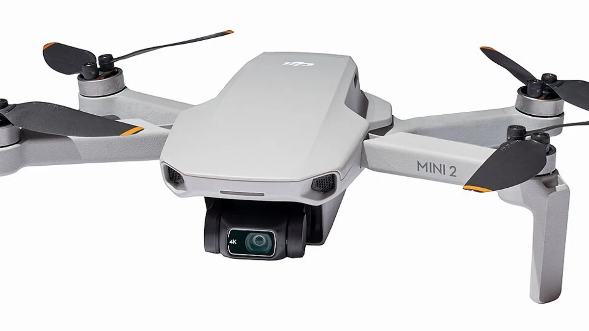
A good outdoor film helps a viewer understand the place and the experience. Aerial footage can show a trail through a valley, the bend of a river or the setting of a campsite. It can also make an activity look faster, steeper or more isolated than it really is. Adventure operators need a production plan that tells the story accurately and fits the activity's own safety system.
This guide is for tourism brands, guides, event teams and film producers planning drone video in India. It covers briefing, participant coordination, terrain, shot choice and publication. The activity leader remains responsible for the activity; the qualified pilot remains responsible for the flight. The two plans need to work together before cameras are added.
Choose one story for the film
A resort introduction, cycling race recap, rafting promotion and trekking route guide answer different questions. A resort viewer may want to see the landscape and how guests reach the property. A race participant may want the route and atmosphere. A trek customer may need realistic terrain and season context. Write the audience and one message before listing drone moves.
For a short film, a simple sequence works: where the experience starts, how people prepare, the main activity, a rest or landscape moment, and how the day ends. Aerials can establish each setting. Ground cameras can show faces, guide instructions, equipment and the small details that a drone cannot capture well. One long follow shot rarely tells the whole story.
Decide where the film will appear. A website hero, horizontal campaign video and vertical reel need different framing. If the client wants several formats, plan safe crop space or dedicated vertical compositions. Add room for captions and logos rather than covering a rider or raft in the edit.
Map the route with the activity lead
The guide or event director should identify the actual route, gathering points, difficult sections, emergency access, staff locations and places where filming is not appropriate. Mark areas where people may unexpectedly enter the frame. A trail used by the public cannot be treated like a closed set merely because a camera crew is present.
Choose a small number of controlled filming zones. For rafting, that may be a shore area with a clear view of a named section. For cycling, a corner or open stretch with an agreed pass. For a trek, a broad ridge view may show the landscape without a drone following hikers at close range. The activity lead and pilot should discuss each zone on site, not rely only on a map.
Ask what happens if the participant takes another route, the water level changes or the group arrives late. The shot list should have an alternative that does not tempt anyone to repeat a risky move for the camera.
Put the activity before the camera
Participants should follow the normal guide or event rules. A rider should not look toward the drone while turning, and a raft team should not change its line to help a tracking shot. If a scene needs a special action, rehearse and approve it through the activity team. The pilot should keep the aircraft from distracting people at a critical moment.
Plan a communication chain. The guide needs to know when filming begins and how to call a stop. The pilot needs to know if weather, water or participant conditions change. Each should be able to cancel the planned shot without debating the marketing value of it. A beautiful clip is not worth adding risk to a live activity.
Natural hazards may include cliffs, trees, cables, unstable ground, moving water, wildlife, wind changes and poor radio or mobile coverage. The crew must identify a safe launch and recovery point for each filming zone. The qualified operator must check current airspace and local restrictions. A remote landscape is not automatically unrestricted airspace.
Use wide shots for context and closer shots selectively
An establishing aerial can show the relation between route, terrain and destination. It can help viewers understand why the activity feels special. Keep enough distance and angle to preserve context. If every shot is a dramatic top-down view, the audience may not understand the actual path or scale.
Closer shots need a separate plan. A drone moving near a cyclist, boat or campsite can affect people who did not join the production. A ground camera or long lens may give a better result with less disruption. Choose the method based on the story and site, not on a desire to use the drone for every frame.
Film supporting details at human height: equipment checks, a guide pointing out the route, boots on a trail, paddles entering the water, food at camp or a quiet view after the activity. These moments make the film believable. Aerials then connect them to the place.
Protect guests and local communities
Agree who will appear in the film and how consent will be handled. A paid actor, guide, event participant and passing visitor may have different expectations. Children need special care and the responsible adult's approval. Avoid filming private campsites, homes or people outside the production simply to make a scene look lively.
Ask the operator and local site team about community use, wildlife and sensitive areas. A drone can disturb animals or draw attention to a place that should remain quiet. If the story includes a protected landscape or cultural site, check the responsible authority's conditions and publication needs. Do not post exact access details to sensitive sites without review.
Keep raw footage access controlled. A wide shot may contain people or property that an editor notices only on a larger screen. Review the whole frame before public use, especially when cutting clips for social media.
Keep the advertising claim true
The film should represent the experience guests can actually book or attend. If a route is seasonal, say so. If a shot uses a closed course, professional participant or special safety team, do not present it as an ordinary unsupervised guest activity. Avoid an edit that removes a required guide or makes a difficult section look suitable for beginners.
Check captions and maps with the activity operator. Aerial distance can make a trail look close to a resort when access takes longer. A river may look calm from high above while conditions at water level are different. State dates and conditions for footage that may be reused after the season changes.
If the campaign mentions travel time, availability, difficulty or safety, the client should verify those statements from its current operating information. A drone image is visual context, not proof of a permanent condition.
Schedule the shoot and edit realistically
Plan around safe activity timing and the best light, but leave weather and delay options. Outdoor conditions can change faster than an indoor production schedule. Make a must-have list and a preferred list so the team can protect the key story if only one zone remains practical. A ground-only alternative may still make a strong film.
The handover should name the approved edit lengths, aspect ratios, stills, captions, music, raw footage if included and usage rights. Review for participant consent, location restrictions, factual claims and outdated visuals before release. Store a clean master so later seasonal versions can be made without rebuilding the edit from rough files.
For the broader production sequence, see the commercial shoot-day guide and privacy guide. The strongest outdoor content shows a real experience clearly while the activity and flight teams remain in control.
FAQs
Can drones film rafting or trekking?
They may be able to film selected, controlled sections after the activity lead and pilot review terrain, people, weather, access and current requirements. Some sections should be filmed from the ground instead.
Can the drone follow participants through a route?
Only when the route, communication, separation and aircraft plan support it. A planned pass in one safe area is different from following a group through an entire live route.
Can adventure footage be used for advertising?
Yes, after checking consent, location rights and the accuracy of the experience shown. A special production setup should be described honestly when it could mislead viewers.
Plan your project
Share your site, dates and intended output so we can confirm a suitable scope.
Sports & Action Coverage · Compare project scope · Get in touch
Related reading
- Sports Event Drone Photography and Video in Bangalore: Planning Guide
- Stadium and Sports-Facility Drone Photography in Bangalore
- Wedding Drone Photography & Aerial Video Guide Bangalore
- Solar Farm Construction Drone Progress Monitoring in India
- Airport and Aviation Facility Drone Documentation in India: Planning Guide
- Pipeline Right-of-Way Drone Mapping and Inspection in India
Contact SkyViews Aerial Drone Studio at +91 90190 56479 or skyviewsdronestudio@gmail.com. Service area: Bangalore, Karnataka and India and wider Bangalore, Karnataka and India.