Airport and Aviation Facility Drone Documentation in India
How aviation and airport-adjacent facilities can plan approved exterior imagery for construction, architecture, landscaping and corporate...
By SkyViews Aerial Drone Studio
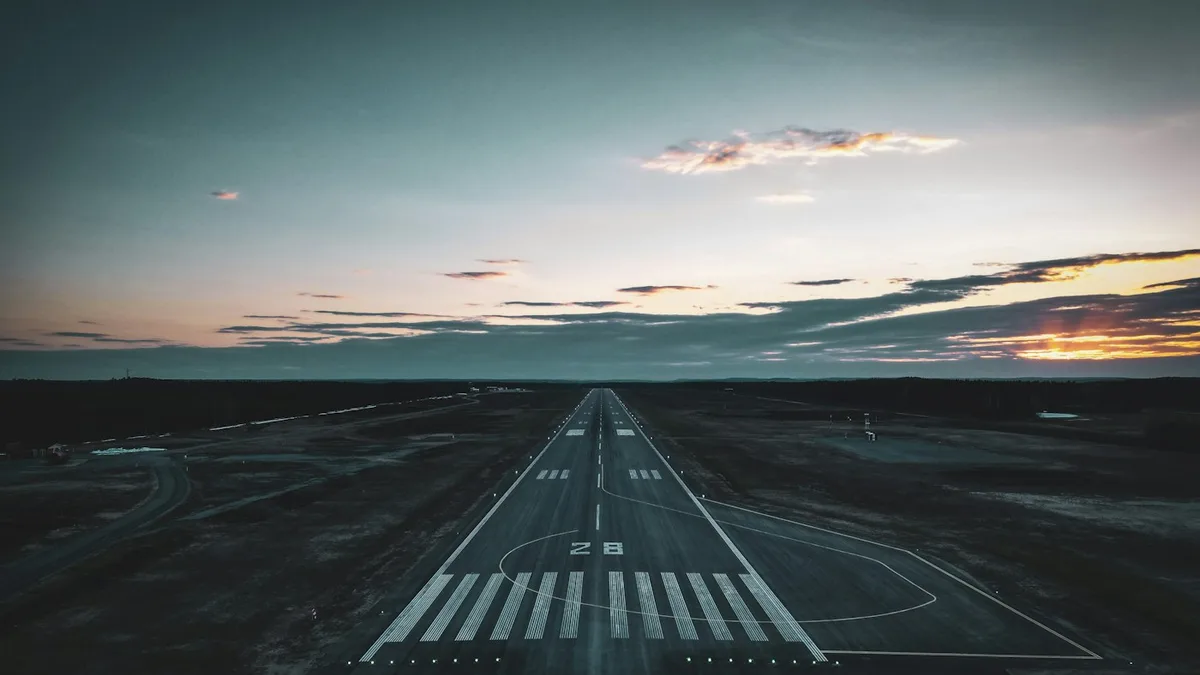
Aviation facilities, aerospace parks and airport-adjacent sites require high care for any drone work. Whether you are filming a new terminal, checking a cargo hangar, surveying an aerospace park or recording a flying school, air safety comes first.
Airports are heavily protected areas. Airplanes, helicopters, radar systems and air traffic control run all day and night. Flying an unapproved drone near an airport is illegal, risky and carries severe fines.
Yet, with proper planning, written permits and trained crews, safe commercial drone filming near airports is done every week. This guide explains how to plan and run legal drone shoots near airports and aerospace centers in India.
Understanding airport airspace zones
Under India's Drone Rules 2021 and the DigitalSky system, airspace around airports has three clear safety zones:
The Red Zone: Active airport grounds
The red zone covers the airport grounds and immediate runway paths. For most civil and military airports, the red zone extends up to 5 kilometers from the airport boundary. No private or commercial drone may fly in a red zone without special written permission from the central government and the DGCA.
The Yellow Zone: Controlled approach corridors
The yellow zone extends from 5 kilometers to 12 kilometers around an active airport perimeter. In this zone, airspace above 200 feet is controlled. Flights in the yellow zone need prior clearance from Air Traffic Control (ATC) through the DigitalSky website.
Green Zones: Safe open airspace
Areas located beyond 12 kilometers from an active airport boundary usually fall into green zones. Here, flights up to 400 feet above ground level need no prior airspace permit. However, pilots must still respect local security buffers near military bases and radar towers.
Common reasons for aviation facility drone shoots
Despite strict airspace rules, real commercial projects often need aerial photos near aviation centers:
- Terminal and runway expansion: Large public works, such as new airport terminals or metro links, need regular progress photos.
- Aerospace industrial parks: High-tech parks (like the Devanahalli aerospace zone near Bengaluru) need marketing videos and building photos.
- Cargo hangars and logistics hubs: High-bay aircraft hangars and cargo warehouses need aerial roof and wall inspections.
- Flying schools and aviation clubs: Pilot academies need crisp video clips for student sign-ups and website showcases.
- Obstacle height surveys: Surveyors use drone mapping to verify that nearby trees and cell towers do not poke into safe aircraft flight paths.
Step-by-step approval steps for airport shoots
Planning a drone flight near an airport requires a clear step-by-step process. Never leave permissions to the last day:
Step 1: Check the site on DigitalSky
Find the exact site on the DigitalSky interactive map. See if the plot sits in a red, yellow or green zone. Measure the exact straight-line distance to the nearest runway center line.
Step 2: Get facility owner and security consent
Get written permission from the facility owner or airport operator, such as BIAL in Bengaluru or the Airports Authority of India. Airport security, usually run by the Central Industrial Security Force (CISF), must check the shoot plan, gear list and crew IDs.
Step 3: File for DigitalSky and ATC clearance
Submit the flight plan on the DigitalSky portal well ahead of the shoot date. For yellow zone flights, work directly with the local Air Traffic Control watch office. Provide exact map coordinates, planned maximum flight height, flight duration and pilot details.
Step 4: Check pilot and drone credentials
Every crew member must hold valid papers. The remote pilot must hold a valid Remote Pilot Certificate (RPC). The drone must have an active Unique Identification Number (UIN). The studio must carry current third-party liability insurance.
Step 5: Day-of-flight tower contact
On the morning of the flight, the remote pilot contacts the airport ATC tower by phone or radio. The pilot confirms runway plans, weather visibility and gives exact take-off and landing times. If the tower orders an immediate landing due to incoming planes, the pilot lands right away.
On-site safety rules near airports
Flying near airport infrastructure demands strict safety habits on the ground:
Set electronic height caps
Set a hard height ceiling in the drone flight app. If your permit allows flight up to 100 feet above ground level, set the software hard ceiling at 95 feet. This stops the drone from climbing into aircraft approach paths by mistake.
Use visual spotters with binoculars
A two-person flight crew is mandatory. While the remote pilot focuses on the drone and camera framing, a visual observer watches the surrounding sky with binoculars. The observer looks out for low-flying helicopters, light planes or emergency medical flights.
Check for radio signal interference
Airports run high-power radar, navigation beams and radios. Strong radio waves can disturb basic drone signals. Use commercial enterprise drones with dual-band frequency hopping and dual compass sensors. Always calibrate the drone compass away from steel hangars and reinforced concrete slabs.
Plan clear emergency landing spots
Pick primary and backup landing spots before take-off. Make sure the automatic return-to-home path does not cross active taxiways, fuel tanks or electrical substations. Set the drone to land in place if the remote control signal drops.
Worked example 1: Aerospace plant in Devanahalli
A precision aerospace parts factory in the Devanahalli industrial zone near Kempegowda International Airport needed marketing photos for global clients.
The site fell within the airport yellow zone. The studio checked the airspace on DigitalSky and picked a safe flight ceiling of 120 feet above ground level. The factory head coordinated with the airport security office and informed plant staff.
The drone pilot logged the flight plan on DigitalSky, finished pre-flight checks and called the duty ATC supervisor. Flights took place during mid-morning when airport traffic had a scheduled lull. The client received sharp 4K videos and high-resolution photos without causing any delay to nearby flights.
Worked example 2: Aviation training hangar inspection
A flight training academy at a regional airfield needed a roof and wall check for its main maintenance hangar.
The hangar stood 800 meters from the grass runway. The flight team worked directly with the airfield safety officer. The inspection took place during a scheduled two-hour runway closure window.
Using a quiet drone with propeller guards and a zoom camera, the pilot captured sharp photos of roof seams, gutters and lightning rods at an altitude of just 60 feet. The visual check finished in two hours, replacing risky ladders and scaffolding.
Client checklist for airport-adjacent shoots
Follow this checklist when planning an airport-area shoot:
- [ ] Check DigitalSky airspace zone (Red, Yellow or Green) for the site.
- [ ] Fix a safe maximum flight height and radius.
- [ ] Secure written permission from the airport operator or facility head.
- [ ] Ensure the pilot holds a valid DGCA Remote Pilot Certificate.
- [ ] Verify active drone UIN registration and third-party liability insurance.
- [ ] Complete security checks with CISF or on-site security guards.
- [ ] Establish direct phone or radio contact with the ATC tower.
- [ ] Use electronic height locks, fail-safe settings and visual observers.
For more details on aviation rules, read our DGCA compliance guide and flight permission checklist.
Frequently asked questions
Can drones fly inside an airport terminal or hangar?
Yes. Indoor drone flights that take place inside an enclosed building or hangar do not operate in public civil airspace. They are not controlled by DGCA airspace zones. However, indoor flights still need building owner consent, prop guards and strict worker safety steps.
How far from an airport can a drone fly without clearance?
Under DGCA rules, areas beyond 12 kilometers from an operational airport boundary are generally classified as green zones, allowing flights up to 400 feet above ground level without prior ATC clearance. Always check your exact site on DigitalSky before flying.
What are the penalties for unauthorized flights near airports?
Flying an unauthorized drone in an airport red or yellow zone violates aviation safety laws. Penalties include immediate drone confiscation, heavy civil fines and criminal charges under the Aircraft Act.
How long does ATC yellow zone clearance take?
DigitalSky yellow zone clearance processing usually takes three to seven working days, depending on airport traffic and local office review times. Planning well in advance is essential.
Plan your project
Share your site, dates and intended output so we can confirm a suitable scope.
Aerial Imaging & Cinematics · Compare project scope · Get in touch
Related reading
- Floodplain Drone Mapping and Water-Risk Documentation in India
- Heritage and Monument Drone Photography in India: Documentation Guide
- Public Park and Landscape Development Drone Documentation in India
- Pipeline Right-of-Way Drone Mapping and Inspection in India
- Stadium and Sports-Facility Drone Photography in Bangalore
- Eco-Resort and Wildlife Conservation Drone Storytelling in India
Contact SkyViews Aerial Drone Studio at +91 90190 56479 or skyviewsdronestudio@gmail.com. Service area: Bangalore, Karnataka and India and wider Bangalore, Karnataka and India.