Commercial Facility Handover Drone Documentation in India
How owners, contractors and facility teams can prepare a dated external-asset visual record for commercial-building handover and operations.
By SkyViews Aerial Drone Studio
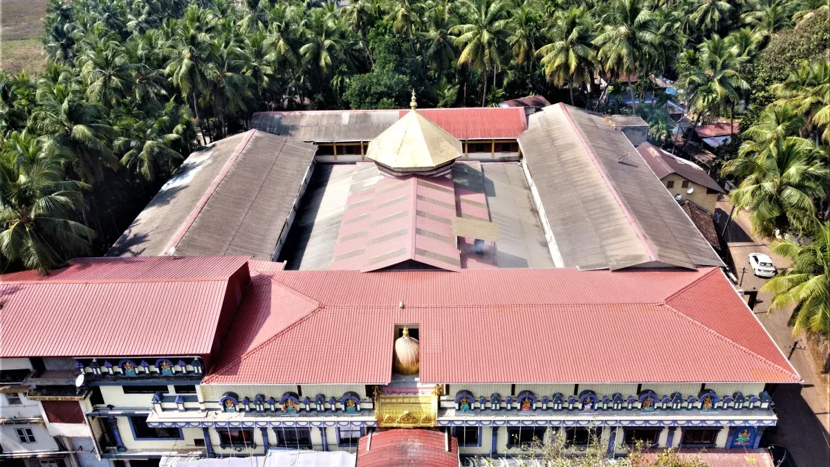
A commercial building may look finished from the road while its new facilities team still has dozens of questions. Which roof drain serves each zone? What did the facade look like before tenants moved in? Where are the loading routes, external signs and plant screens? Dated drone images can help answer these visual questions and give the owner a starting record for future maintenance.
This guide explains how to commission a useful aerial handover in India. The images support the formal handover file; they do not certify construction quality, hidden systems or legal completion. The owner, contractor and receiving facilities team should decide which assets need a visual record, who will review it and how it will be stored.
Handover Objectives & Site Coordination
Agree the purpose before the final shoot
Handover images can serve several jobs. The owner may want evidence of visible external condition on a particular date. The maintenance team may want labelled views of roofs, elevations and access areas. A leasing team may want a few approved images for marketing. These outputs can come from one capture, but they need different selection, captions and access rights.
Write down the main handover questions. Can the facilities team find each roof zone? Are there visible unfinished areas that need a follow-up? Which access route serves a loading bay? Is a landscape area complete on the capture date? A brief based on these questions produces a more useful record than a request for “aerial photos of the building”.
Schedule the capture at a stage when the record will be meaningful. Too early, and temporary works dominate the pictures. Too late, and tenant fit-out or new signs may hide the condition at contractor handover. If the project has several blocks or phases, give each phase its own date and status instead of combining them into one undated album.
Draw the handover boundary
List every building, roof, facade, yard, parking area, access road, landscape zone and external equipment area that should be covered. Use the project's existing block and asset names when possible. Mark the extent on a plan so the crew knows where the brief ends. An omitted rear elevation or service yard can become a costly gap when the receiving team later needs a baseline.
For each area, state the intended view. A roof overview shows the arrangement of plant and drainage paths; a closer photograph may show a specific parapet or sign. A facade set should identify compass direction or gridline. A loading yard record should show entrances, turning space and fixed equipment. Keep the list practical so the crew can deliver clear evidence within the safe flight window.
Mark exclusions before capture. Some areas may be blocked, restricted, hidden by temporary structures or outside the client's control. The final coverage note should show these gaps. A blank area in an image folder should never be mistaken for confirmation that the area was checked.
Coordinate with the live site
Even near handover, a commercial property can contain workers, lifts, deliveries, neighbouring tenants and visitors. The site manager and pilot should review safe access, active work, cranes or access equipment, nearby roads and any no-film areas. The pilot makes the flight decision from current conditions. A planned photo day should have room for weather or site changes.
Tell the relevant security and facilities staff what the crew is doing. This avoids a flight being stopped because the receiving team was not informed. If a view would expose a private neighbouring area or sensitive security detail, change the angle or the output. The record should serve the client without gathering unnecessary information.
If an essential view cannot be captured, identify another suitable method. Ground photography, a roof access visit or a contractor's closeout photograph may fill the gap. Document the source of that image so it is not confused with the drone set.
Orientation Capture & Closeout Records
Capture orientation before detail
Begin with a small number of wide views showing how the buildings, roads and service spaces relate. Then collect views by block and zone. A close image of a roof joint is hard to use if nobody can locate it on the building. Include enough surrounding context in each sequence for the facilities team to find the subject later.
Keep the camera position and view direction in an index. Use stable asset IDs where the client has them. If a roof is divided into north and south zones, use those labels in filenames and report captions. A receiving manager should be able to move from an observation to the source image and then to the physical place.
Photograph visible completion honestly. If a section is still under work, say so. If a temporary barrier blocks a facade, include the obstruction and note the missing view. Do not crop away unfinished work in the operational handover file. A marketing edit may be selective, but the technical record should explain its limits.
Separate observations from closeout decisions
Drone imagery can record that a panel appears displaced, an area remains scaffolded, debris is visible near a drain or a sign has not been installed. It cannot establish why a condition exists or whether a system passes a test. The report should use plain descriptions and identify the next reviewer.
For example, “staining visible below south parapet on 18 October” is an observation. “waterproofing failed” is a diagnosis requiring more evidence. “contractor to inspect and respond” is a follow-up action. Keep those fields separate. The handover team can then add the action to its snag list without treating a picture as a certified finding.
Use an observation ID and status. The record can say open, assigned, checked or closed. Link any later repair photograph to the original observation. An image that shows a finished surface may support closeout, but the responsible professional still confirms the work against the contract and applicable checks.
Build a package the facilities team can open
Agree the deliverables in writing: original images, selected labelled views, an image index, an annotated report and any map or model. State the file formats and whether raw footage is included. A few polished stills are useful for communication but may not be enough for a maintenance archive.
Create a simple folder structure by project, date, block and output type. Keep originals separate from marked-up review copies and public marketing exports. Names should sort clearly and match the asset register. If the client's document system changes filenames on upload, preserve a mapping between the delivered name and the stored record ID.
The receiving team should test a sample. Can it open the image at full size? Does the index point to the correct roof or elevation? Are coordinates, if provided, labelled with their meaning and accuracy? A camera geotag may help find a photograph but is not automatically a measured asset location.
Record Integration, Public Review & Acceptance
Keep other handover records connected
The aerial set works best alongside drawings, equipment lists, warranties, tests, manuals and the snag register. Link to those records only where the client has a clear system for maintaining the links. Do not paste untraceable screenshots into a report and discard the source files.
A roof image can help a new manager find a plant item. It does not prove the plant's commissioning result. A facade image can show visible condition on a date. It does not certify structural or fire performance. A landscape image can show what was planted. It does not prove survival or the maintenance obligation. Each specialist record should remain the authority for its own question.
If the building changes after handover, keep the original baseline. Later surveys can use the same zone names and repeat key viewpoints. A future leak or facade complaint can then be compared with the dated initial condition rather than relying on memory.
Review the public version separately
The owner may want to use the same capture for leasing or a launch campaign. Create an approved public selection rather than distributing the operational archive. Check construction stage, tenant signs, neighbouring property, people, plates, security points and any caption about completion. A promotional image should not imply that a feature is open or certified when the handover record says otherwise.
Record who approved each public version and what use was agreed. A crop made months later should be checked against the same facts. The operational file and the campaign file can share a source image while serving different audiences.
Final acceptance check
The handover is useful when the facilities team can find each agreed exterior asset, see a dated source view, identify gaps and assign follow-up. Check the boundary, file count, labels, links, versions and access permissions before closing the job. Keep the limitations note with the images. A well-organised aerial record makes future maintenance easier to plan while leaving formal certification to the responsible handover process.
Plan your project
Share your site, dates and intended output so we can confirm a suitable scope.
Explore drone services · Compare project scope · Get in touch
Related reading
- Commercial Drone Data Security in India: Client Planning Guide
- Commercial Drone Shoot Call Sheet: What to Include Before Crew Arrival
- Commercial Drone Shoot Contract Checklist for India Clients
- Drone Survey vs Total Station vs Laser Scan: Which Method Fits?
- Drone vs Helicopter Aerial Filming in India: Production Comparison
- What to Expect on a Commercial Drone Shoot Day in India
Contact SkyViews Aerial Drone Studio at +91 90190 56479 or skyviewsdronestudio@gmail.com. Service area: Bangalore, Karnataka and India and wider Bangalore, Karnataka and India.