Logistics Yard and Warehouse Drone Progress Monitoring in India
How logistics parks, warehouses and distribution hubs can use aerial imagery for construction progress, circulation, expansion and property...
By SkyViews Aerial Drone Studio
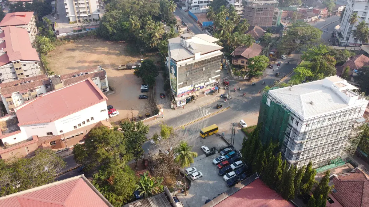
Logistics sites change quickly: buildings expand, yards move, trucks queue, access roads shift and temporary storage appears. Aerial documentation can help teams communicate those changes, provided the brief distinguishes operational reporting from marketing and inspection.
Define the warehouse yard monitoring objective
Choose construction progress, yard circulation, expansion, tenant presentation, loading access, roof or facade record, asset context or investor update. State the boundary, reporting cadence and intended audience.
Coordinate around active logistics operations
Identify forklifts, trucks, cranes, loading windows, staff, security, no-film zones, power systems, take-off area and the site contact. A quiet window may improve both safety and visual clarity, but the final operating decision belongs to the pilot and site plan.
Establish repeatable yard progress benchmarks
Use repeatable viewpoints, dates, asset labels and a short report. Record temporary works, weather, blocked areas and anything not captured. Do not turn a visible image into a contractual completion certificate without the responsible project team.
Separate promotional footage from operational reporting
Marketing films need brand, scale and access storytelling. Progress or inspection records need repeatability, annotations, evidence and limits. One visit may create both, but the shot lists and acceptance criteria should be separated.
Pick the decision the yard report should support
A logistics manager may want to understand a new truck route, an investor may want to see building progress, and a tenant may want a clear view of loading doors. These are different questions. Write down the decision owner, area and reporting period before booking a flight. A wide yard photo can show the layout, but it cannot tell the team why trucks queued on a particular morning. A useful report pairs the image with the operating context supplied by the site team.
Divide the property into named zones: gate, queue area, parking, loading face, warehouse block, expansion site, container yard and access road. Use the site's existing names where possible. If a block is leased to another tenant, confirm the boundary and the right to film it. A simple marked overview helps a new reviewer understand where each later image belongs. Keep the plan revision and capture date in the report so changes in layout are not mistaken for camera error.
Plan around vehicles and people
Truck and forklift routes can change within minutes. The facility contact should identify delivery peaks, reversing zones, temporary closures, overhead cables and the safe place for the crew. The pilot checks current airspace, wind and a recovery route that stays clear of moving equipment. Agree on a stop signal and who can call it. A “quiet window” helps, but it still needs an active site contact because an urgent delivery may arrive unexpectedly.
Do not ask drivers to change normal traffic patterns for an unplanned camera angle. If the shoot requires a controlled vehicle movement for marketing, schedule and supervise it separately. A staged route should not be presented later as evidence of normal throughput. Likewise, a single image of an empty queue does not prove that access works well at peak time. The operations team should own any traffic or capacity claim.
Capture a useful baseline
Start with a whole-site view and repeat views of the named zones. Record the camera direction, date, approximate time, weather and operating condition. For construction progress, include the building shell, yard paving, drainage, gates and external utilities that the project team has asked to see. For circulation, include entries, exits, turning areas and conflicts that can be viewed safely. For a roof or facade condition record, use a different close-detail plan with asset IDs.
Make a coverage map. A stacked container, parked trailer or active crane may block part of the yard. Mark that zone as unseen, not unchanged. Keep originals and labelled selects. A highlight reel can explain the facility to a client, but still images with consistent viewpoints are usually easier for a progress meeting to compare month by month.
Compare change without inventing performance
Aerial views can show a new building wing, resurfaced yard, moved fence or changed parking layout. They cannot prove that the new loading process is faster, a warehouse is commissioned, or the pavement passed an engineering test. Put those claims in separate fields with the facility or project record as source. If the report uses a percentage complete, the project team must define the denominator and certification method. A drone image alone is a visual record.
For month-to-month work, pair the same view and give both dates. Note temporary storage, traffic changes, weather and blocked views. A yard may look congested one day because of a scheduled shipment, not because its design is inadequate. Ask operations for a brief context note before writing a conclusion. A report that describes the visible scene and its limits is more trustworthy than one that turns every busy frame into an operational diagnosis.
Support construction and expansion meetings
An expansion project often sits beside live distribution work. A dated aerial overview can show how the new hall, access road and utility corridor fit around active traffic. Split the report by work package and label what is visibly built. Keep an “outside camera view” field for interior racking, electrical work, testing and acceptance. The project manager can combine this with its schedule and quality records. The construction KPI guide explains why visible progress and certified progress should remain separate.
If earthwork or yard quantities are needed, commission a measured mapping scope with ground control, checkpoints, base surface and accuracy requirement. A visual image map can help orientation, but it should not be used as a payment survey merely because it has coordinates. The survey lead should identify the ground that trucks, containers or roofs obscured.
Build marketing views that answer a tenant's question
A tenant may want to see the gate, approach, building frontage, dock positions and relationship to major roads. Use aerial images for that context and ground images for dock details, interiors and actual operating features. Verify any claims about clear height, floor load, power, parking capacity or travel time from facility records. The drone cannot measure or certify those facts from a wide shot. The warehouse marketing guide covers a tenant-facing shot list.
Keep public footage separate from restricted operational images. High-resolution files can expose vehicle plates, shipment details, security routes or tenant operations. Review both foreground and background with the facility. A marketing editor should work from an approved selection, not a full progress archive. Agree on usage channels and retention at the beginning of the project.
Example: an active warehouse adding a new yard
Suppose a distribution hub is extending its paved yard while trucks continue to use the old gate. The project team wants monthly evidence of paving, drainage and the new gate. Operations wants to know whether the temporary traffic route remains clear. The pilot and site lead schedule a quiet window and capture a whole-site view, repeat images of the new work zone and a safe view of the temporary route. The report notes two areas hidden by parked trailers.
The next month, the same views show visible paving and a moved fence. The project engineer uses separate test and acceptance records for the pavement. Operations checks the route on the ground before changing traffic instructions. The investor update uses one dated approved image, while the internal report keeps all the work-zone detail. Each audience gets evidence suited to its decision.
What to include in the first request
Send the site map, zone names, operating schedule, audience, desired cadence, priority decisions and no-film areas. Ask for a safe capture plan, repeat-view register, file naming, gap list, review process and the split between internal and public outputs. Name the person who can verify operational captions. A useful logistics report does not need to promise that one drone flight reveals the whole business; it needs to show the right changes clearly and leave operational conclusions with the team that runs the yard.
See the warehouse marketing guide and construction case-study template.
FAQs
Can a warehouse stay operational during a drone shoot?
Possibly, with facility approval, controlled timing, safety coordination, privacy planning and site-specific feasibility review.
Can drones show truck circulation and access?
They can document visible circulation and context, but traffic or operational conclusions should be reviewed by the facility team.
Can logistics sites receive monthly reports?
Yes. Recurring reports can use consistent viewpoints, asset labels and deliverables while recording changes and limitations.
Plan your project
Share your site, dates and intended output so we can confirm a suitable scope.
Construction & Infrastructure · Compare project scope · Get in touch
Related reading
- Construction Drone Progress Monitoring in Bangalore: A Practical Guide
- Solar Farm Construction Drone Progress Monitoring in India
- Wind Farm Construction Drone Progress Monitoring in India
- Commercial Drone Shoot Contract Checklist for India Clients
- Drone Flight Permission Planning Checklist for India: Verify Before Booking
- RTK, PPK and GCPs in Drone Surveys: Accuracy Explained for Indian Projects
Contact SkyViews Aerial Drone Studio at +91 90190 56479 or skyviewsdronestudio@gmail.com. Service area: Bangalore, Karnataka and India and wider Bangalore, Karnataka and India.