School and College Campus Drone Photography in India: Planning Guide
How schools, universities and education groups can plan aerial campus photography for admissions, architecture, events, expansion and annual...
By SkyViews Aerial Drone Studio
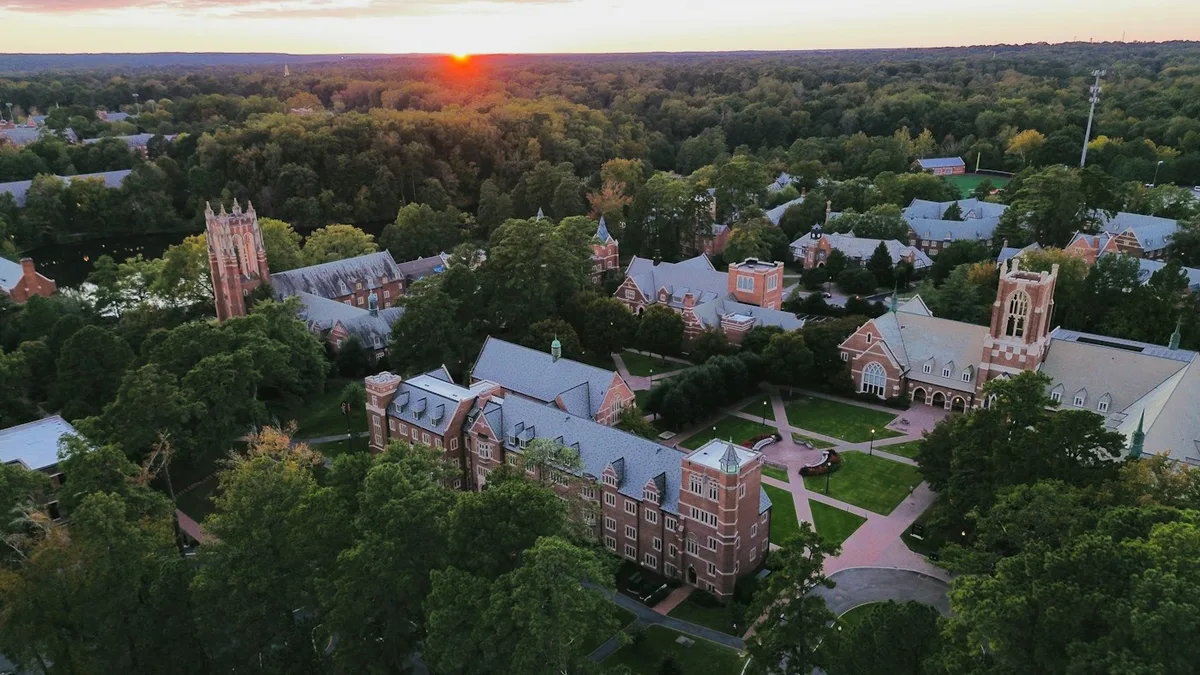
A campus is easier to understand when its buildings, paths, sports areas and open space can be seen together. Aerial photography can help a prospective student find the main entrance, show how an institution has grown or document a new building. Education sites also have a special duty of care. A shoot must fit the timetable and the institution's rules for students, staff and publication.
This guide is for schools, colleges and universities in India planning drone photographs or video. It covers the brief, site schedule, privacy, accurate captions and delivery. The institution and pilot should assess each proposed flight under the actual conditions. An attractive campus view is valuable only if the people who use the place are protected and the image describes the current site honestly.
Campus Mapping & Schedule Coordination
Decide who needs to understand the campus
Admissions teams may want to show arrival, buildings, sports grounds and landscape. Alumni teams may want a visual update on a new wing. A facilities team may need a dated record of roofs and expansion. An accreditation or annual-report team may need a specific overview with clear labels. These are different outputs, even if the aircraft flies on the same day.
Write the audience and question for each planned asset. A parent might ask where the bus drop-off sits. A student might want to understand the relationship between libraries and teaching blocks. A project manager may need to compare construction stages. Choose views that answer those questions before adding a cinematic orbit.
Separate public storytelling from internal records. A maintenance image may show security detail or a roof defect that does not belong in an admissions film. Create different folders and approval paths rather than sharing one raw archive widely.
Build a campus map for the crew
Ask the institution for current building names, entrances, paths, play areas, sports spaces and no-film zones. Use the names that students and staff use. A camera operator cannot guess that a building is a senior school block or that a road is for service vehicles only. Mark the real visitor approach and any areas that must be excluded.
Choose an establishing view that shows the whole layout, then a smaller set of purposeful views. Aerial height can explain how buildings and outdoor spaces connect. Ground footage may show classrooms, libraries, labs and student experience more clearly. The final story should use each perspective for the question it answers best.
If the campus has more than one site, give each its own ID and date. Do not combine footage from separate campuses into one sequence that implies they form a single walkable property.
Use the timetable to reduce disruption
Term dates, exams, assemblies, sports practice, transport periods and events affect when and where a crew can work. The school or college should nominate a contact who knows the daily schedule. An empty or low-activity window may suit architecture photographs. If the story needs people, plan that separately with the institution's own consent and safeguarding process.
Notify security, transport and facilities staff. A surprise drone can distract students or cause people to leave a planned area. The pilot should know who can stop the activity and where a safe recovery area is. A timetable can change on the day, so the crew needs a fallback shot list.
Weather and light also matter. A sunrise view may give a calm campus image but may not be a workable time for access. Plan a realistic window and a weather alternative. The shoot should not pressure a pilot to fly when conditions or school activity are unsuitable.
Safety Protocols & Facility Storytelling
Protect students and staff by design
Plan angles that avoid unnecessary identifiable images of children and private activities. Do not rely only on blurring faces later. A wide image may still show uniforms, names, vehicle plates or a group in a sensitive setting. The institution should review what the camera can see and what may be published.
Keep classroom windows, residential areas, medical rooms, staff spaces and neighbouring homes in mind. Aerial views can reveal things that a normal visitor would not see from the ground. Mark no-film directions before flight. If a view cannot be taken without collecting unnecessary private detail, choose another view.
The institution should define who approves people-focused content. A ground shoot with planned participants may be better than trying to capture a natural-looking crowd from above. Keep any source files containing identifiable people under suitable access controls.
Explain current facilities accurately
A prospectus image should show what exists now. A future building, planned sports facility or temporary event setup needs a clear label. Do not make a building under construction look open through a crop or a smooth edit. Date the images when campus change could make an old view misleading.
Check names, access and availability. A sports ground may be shared with another organisation. A new library may not yet be in use. A bus entrance may not be open to visitors. The admissions team should verify these facts before captions or voiceover are approved.
For an expansion film, use separate current and proposed visuals. A render over an aerial image can help people imagine a future campus, but the transition must be labelled. Preserve the original image for the internal record.
Capture for the real output
A website banner needs a clear subject and space for text. A vertical reel needs a composition that fits a narrow screen. A prospectus still needs enough resolution and a calm frame. A construction update needs repeatable viewpoints and dates. Tell the pilot and editor these uses before filming.
Capture a mix of overview, arrival and detail. A top-down shot can explain sports-ground layout but may hide the facade that gives a campus its identity. An oblique view can show buildings and landscape together. Ground footage can supply texture and human scale. Keep the aerial set focused instead of trying to show every activity from the sky.
If the institution plans yearly updates, record viewpoint IDs. A later photograph from the same direction can show a new building or changed landscape clearly. When new construction blocks a view, document the replacement rather than pretending the images match exactly.
Stakeholder Approvals & Handover Packages
Organise approvals before editing
Make a fact and rights sheet. It should include correct campus name, building labels, year or term, permitted student appearances, approved logos, music and the intended channels. Name the institutional reviewer for accuracy, the safeguarding reviewer for people, and the final communications approver. One person can consolidate comments for the editor.
Review the first selection before a polished cut. This is the easiest stage to remove a restricted view or replace a shot that misidentifies a building. A later review can check captions, proposed features and final formats. Keep a copy of the approved version so an earlier draft is not posted by mistake.
Use different packages for different teams
An admissions package may contain a hero film, a few stills, short reels and captions. A facilities package may contain dated originals, building IDs, an image index and coverage limits. A construction package may include repeat views and a progress report. They can share source capture but should not share every file or claim.
Name files by campus, building, date, use and version. Store raw footage with the institution's chosen access controls. If the marketing team needs a later edit, it should know which clips are approved for public use and which need another review.
Example: documenting a new academic block
Suppose a college wants to show a newly opened academic block while keeping a record of continuing work on a nearby sports area. The aerial plan captures the main visitor approach, the completed block and the wider campus during a quiet window. The marketing edit uses approved views of the open building with verified captions. The project report keeps dated views of the sports construction. The two stories remain clear, and neither suggests that the unfinished area is ready for students.
That separation is the practical standard for campus content: choose the audience, protect the people on site and describe the facility as it actually exists. For a deeper privacy plan, see the privacy guide.
Plan your project
Share your site, dates and intended output so we can confirm a suitable scope.
Aerial Imaging & Cinematics · Compare project scope · Get in touch
Related reading
- Campus Drone Photography in Bangalore: Corporate, School & Institutional Sites
- Co-Working and Corporate Campus Drone Photography in Bangalore
- Hospital and Healthcare Campus Drone Photography in Bangalore
- Urban Planning Drone Mapping for City Development in India
- Construction Drone KPI and Progress Reporting Guide for India
- Chimney and Industrial Stack Drone Inspection in India: Planning Guide
Contact SkyViews Aerial Drone Studio at +91 90190 56479 or skyviewsdronestudio@gmail.com. Service area: Bangalore, Karnataka and India and wider Bangalore, Karnataka and India.